


RommeDepuisScionzier

raymondfn
User
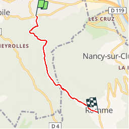

Length
4 km

Max alt
1298 m

Uphill gradient
794 m
Km-Effort
11.9 km

Min alt
506 m

Downhill gradient
4 m
Boucle
No
Creation date :
2019-01-03 22:01:11.652
Updated on :
2019-01-03 22:01:11.652
2h41
Difficulty : Medium

FREE GPS app for hiking
 SityTrail
IGN / Geographical institutes
SityTrail Plus
The world is yours!
About
Trail Walking of 4 km to be discovered at Auvergne-Rhône-Alpes, Upper Savoy, Scionzier. This trail is proposed by raymondfn.
Positioning
Country:
France
Region :
Auvergne-Rhône-Alpes
Department/Province :
Upper Savoy
Municipality :
Scionzier
Location:
Unknown
Start:(Dec)
Start:(UTM)
310590 ; 5102833 (32T) N.
Comments