Trail Mountain bike Dourgne - Dourgne, Montagne noire - Photo

Dourgne, Montagne noire

 tracegps
tracegps

User

© OpenStreetMap contributors
Length
Length
34 km
Max alt
Max alt
787 m
Uphill gradient
Uphill gradient
1174 m
Km-Effort
Km-Effort  
49 km
Min alt
Min alt
259 m
Downhill gradient
Downhill gradient
1171 m
Boucle
Boucle
No
Creation date :
2014-12-10 00:00:00.0
Updated on :
2014-12-10 00:00:00.0

(0 Reviews)

Mountain bike
Mountain bike
4h30
Difficulty : Very difficult

Scan this QR Code to open this trail in the SityTrail application

FREE GPS app for hiking

Logo SityTrail SityTrail

IGN / Geographical institutes

Download SityTrail from the App Store Download SityTrail from Google Play

Logo SityTrail SityTrail World

The world is yours!

Download SityTrail from the App Store Download SityTrail from Google Play Download SityTrail on Huawei AppGallery

About

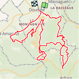
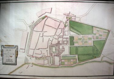
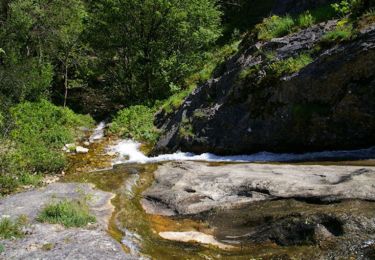
Trail Mountain bike of 34 km to be discovered at Occitania, Tarn, Dourgne. This trail is proposed by tracegps.

Description

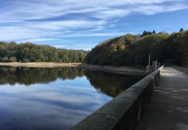
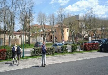
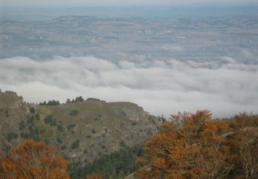
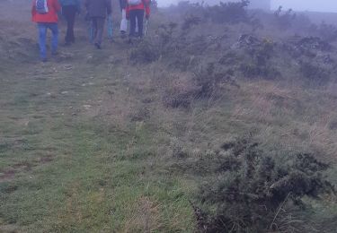
23 Avril 2005 Foutue météo ! Demain normalement doit avoir lieu la St-affricaine, mais les prévisions ne sont guère alléchantes, voir même rebutantes ! Dès vendredi, sur le forum on savait tous que la st-affricaine se déroulerait sans nous cette année ! Vraiment dommage car ça m'a l'air sympa ! Tant pis, quelqu'un a-t-il une solution de rechange pour samedi vu que le temps a l'air plus clément ?! Rowel ? Oui, bon OK, ce sera Dourgne et la montagne noire... La suite est ICI

Elevation profile

Photos

Positioning

Country:
France
Region :
Occitania
Department/Province :
Tarn
Municipality :
Dourgne
Location:
Unknown
Start:(UTM)
430470 ; 4814889 (31T) N.

Trails nearby

Trail Walking Dourgne - Désert de St Férréol - Photo
Walking
tracegps

Walking

Medium
(1)
Dourgne, Occitania, Tarn, France
7.6 km | 12.1 km-effort
3h 45min
Yes
Trail Electric bike Dourgne - Capelette table orientation  - Photo
Electric bike
NICOLAS VEITH

Electric bike

(1)
Dourgne, Occitania, Tarn, France
21 km | 30 km-effort
1h 59min
No
Trail Walking Dourgne - rando dourgne - Photo
Walking
Mamilaure

Walking

Medium
Dourgne, Occitania, Tarn, France
13 km | 18.5 km-effort
3h 32min
Yes
Trail On foot Sorèze - La boucle du Bois Grand - Photo
On foot
PRO

On foot

Easy
Sorèze, Occitania, Tarn, France
7 km | 10.7 km-effort
2h 26min
Yes
Trail Mountain bike Dourgne - La Croix des fangasse , les Escudiers , arfons  - Photo
Mountain bike
cironav

Mountain bike

Medium
Dourgne, Occitania, Tarn, France
23 km | 0 m-effort
3h 24min
Yes
Trail Walking Dourgne - Dourgne - Revel - Photo
Walking
RR31

Walking

Medium
Dourgne, Occitania, Tarn, France
22 km | 25 km-effort
2h 39min
No
Trail Walking Dourgne - Le désert de St Férréol - Photo
Walking
tracegps

Walking

Medium
Dourgne, Occitania, Tarn, France
7.6 km | 12.1 km-effort
3h 45min
Yes
Trail Mountain bike Verdalle - Taurou-Sant - Photo
Mountain bike
tracegps

Mountain bike

Difficult
Verdalle, Occitania, Tarn, France
38 km | 50 km-effort
3h 30min
Yes
Trail Walking Dourgne - De Ste Scholastique à chapelle St Ferréol la Capelette - Photo
Walking
geli.henri

Walking

Easy
Dourgne, Occitania, Tarn, France
6.5 km | 10.4 km-effort
2h 13min
Yes


Close
My subscriptions