Trail Mountain bike Saint-Sulpice-la-Pointe - Forêt de Mézens - Photo
 tracegps
tracegps

User

© OpenStreetMap contributors
Length
Length
32 km
Max alt
Max alt
252 m
Uphill gradient
Uphill gradient
536 m
Km-Effort
Km-Effort  
39 km
Min alt
Min alt
99 m
Downhill gradient
Downhill gradient
536 m
Boucle
Boucle
Yes
Creation date :
2014-12-10 00:00:00.0
Updated on :
2014-12-10 00:00:00.0

(0 Reviews)

Mountain bike
Mountain bike
2h00
Difficulty : Difficult

Scan this QR Code to open this trail in the SityTrail application

FREE GPS app for hiking

Logo SityTrail SityTrail

IGN / Geographical institutes

Download SityTrail from the App Store Download SityTrail from Google Play

Logo SityTrail SityTrail World

The world is yours!

Download SityTrail from the App Store Download SityTrail from Google Play Download SityTrail on Huawei AppGallery

About

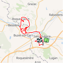
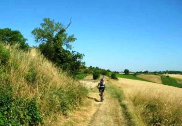
Trail Mountain bike of 32 km to be discovered at Occitania, Tarn, Saint-Sulpice-la-Pointe. This trail is proposed by tracegps.

Description

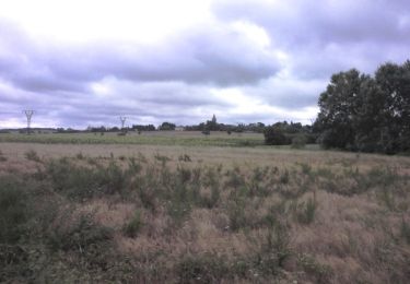
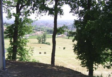
Route ou VTT ? Dilemne ! Pour rouler seul, j'aime autant la route, mais bon... Le week-end prochain, il y a "les camins de la blanqueta" à proximité de Limoux et l'organisateur m'a aimablement prévenu que si le circuit prévu n'est pas très long, il est assez costaud ! Allez, je vais sortir le LP, et puis m'essayer aux côteaux de Mézens, plus précisément à la forêt de Mézens !... La suite est ICI

Elevation profile

Photos

Positioning

Country:
France
Region :
Occitania
Department/Province :
Tarn
Municipality :
Saint-Sulpice-la-Pointe
Location:
Unknown
Start:(UTM)
394416 ; 4845916 (31T) N.

Trails nearby

Trail Mountain bike Mézens - mezensolite2012 - Photo
Mountain bike
stephvtt31

Mountain bike

Medium
(1)
Mézens, Occitania, Tarn, France
32 km | 45 km-effort
Unknown
Yes
Trail Running Azas - De Azas au ruisseau de Toupiac - Photo
Running
tracegps

Running

Medium
Azas, Occitania, Haute-Garonne, France
8.4 km | 9.9 km-effort
49min
Yes
Trail Running Azas - Les chemins d'Azas à Lugan - Photo
Running
tracegps

Running

Medium
Azas, Occitania, Haute-Garonne, France
14.2 km | 17.2 km-effort
1h 30min
Yes
Trail Mountain bike Azas - Les chemins d'Azas à Lugan - Photo
Mountain bike
tracegps

Mountain bike

Medium
Azas, Occitania, Haute-Garonne, France
14.2 km | 17.2 km-effort
1h 10min
Yes
Trail Walking Azas - Les chemins d'Azas à Lugan - Photo
Walking
tracegps

Walking

Medium
Azas, Occitania, Haute-Garonne, France
14.2 km | 17.2 km-effort
3h 30min
Yes
Trail Running Roquesérière - Autour de Roquesérières par le ruisseau de la Mouline d'Azas - Photo
Running
tracegps

Running

Medium
Roquesérière, Occitania, Haute-Garonne, France
10.1 km | 12.1 km-effort
1h 15min
Yes
Trail Walking Roquesérière - Autour de Roquesérières par le ruisseau de la Mouline d'Azas - Photo
Walking
tracegps

Walking

Medium
Roquesérière, Occitania, Haute-Garonne, France
10.1 km | 12.1 km-effort
2h 19min
Yes
Trail Mountain bike Mézens - La Méz'aventure 2005 - Photo
Mountain bike
tracegps

Mountain bike

Very difficult
Mézens, Occitania, Tarn, France
57 km | 76 km-effort
6h 0min
Yes
Trail Mountain bike Saint-Sulpice-la-Pointe - Giroussens, Mézens - Photo
Mountain bike
tracegps

Mountain bike

Difficult
Saint-Sulpice-la-Pointe, Occitania, Tarn, France
56 km | 66 km-effort
3h 0min
Yes


Close
My subscriptions