Trail Mountain bike Capvern - Les Baronnies (65) autrement - Photo

Les Baronnies (65) autrement

 tracegps
tracegps

User

© OpenStreetMap contributors
Length
Length
48 km
Max alt
Max alt
1271 m
Uphill gradient
Uphill gradient
1393 m
Km-Effort
Km-Effort  
67 km
Min alt
Min alt
348 m
Downhill gradient
Downhill gradient
1395 m
Boucle
Boucle
Yes
Creation date :
2014-12-10 00:00:00.0
Updated on :
2014-12-10 00:00:00.0

(0 Reviews)

Mountain bike
Mountain bike
3h00
Difficulty : Very difficult

Scan this QR Code to open this trail in the SityTrail application

FREE GPS app for hiking

Logo SityTrail SityTrail

IGN / Geographical institutes

Download SityTrail from the App Store Download SityTrail from Google Play

Logo SityTrail SityTrail World

The world is yours!

Download SityTrail from the App Store Download SityTrail from Google Play Download SityTrail on Huawei AppGallery

About

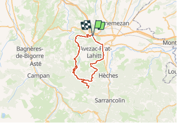
Trail Mountain bike of 48 km to be discovered at Occitania, Hautespyrenees, Capvern. This trail is proposed by tracegps.
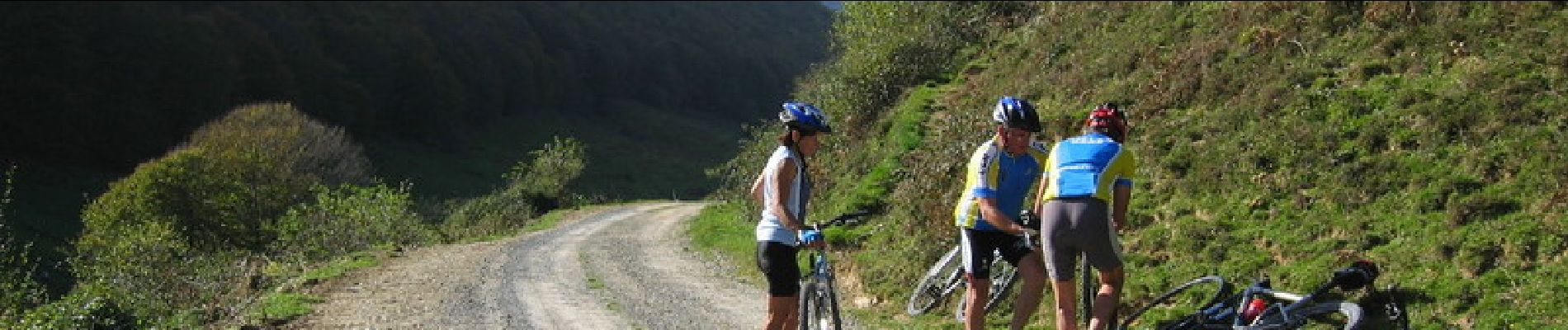
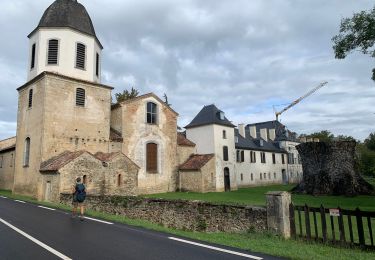
Elevation profile

Photos

Positioning

Country:
France
Region :
Occitania
Department/Province :
Hautespyrenees
Municipality :
Capvern
Location:
Unknown
Start:(UTM)
282723 ; 4775054 (31T) N.

Trails nearby

Trail Other activity Lannemezan - Les Mérens 15 - Photo
Other activity
jmquentin

Other activity

Very easy
(1)
Lannemezan, Occitania, Hautespyrenees, France
15 km | 18.6 km-effort
Unknown
Yes
Trail Walking Lannemezan - Circuit de Lannemezan (Sud) - Photo
Walking
tracegps

Walking

Medium
Lannemezan, Occitania, Hautespyrenees, France
10.6 km | 12.1 km-effort
2h 40min
Yes
Trail Walking Lannemezan - Circuit de Lannemezan (Nord) - Photo
Walking
tracegps

Walking

Easy
Lannemezan, Occitania, Hautespyrenees, France
7 km | 8.5 km-effort
1h 45min
Yes
Trail Walking Mauvezin - 2023 09 22 CHEMIN du PIÉMONT PYRÉNÉEN - 15ème étape : St Bertrand de Comminges … 🚗 … Mauvezin - Abbaye de L’Escaladieu - Bagnères de Bigorre. - Photo
Walking
LEGUE

Walking

Medium
Mauvezin, Occitania, Hautespyrenees, France
22 km | 30 km-effort
4h 59min
No
Trail Walking Batsère - batsere G3 fait - Photo
Walking
LouisROGER

Walking

Very easy
Batsère, Occitania, Hautespyrenees, France
13 km | 19.4 km-effort
4h 57min
Yes
Trail Walking Lagrange - Circuit de Lagrange - Photo
Walking
tracegps

Walking

Easy
Lagrange, Occitania, Hautespyrenees, France
6 km | 8 km-effort
1h 30min
Yes
Trail Walking Capvern - capvern G3 fait 2022 - Photo
Walking
LouisROGER

Walking

Difficult
Capvern, Occitania, Hautespyrenees, France
12.1 km | 17.6 km-effort
5h 40min
Yes
Trail Walking Espèche - Espèche-Bagnères de Bigorre  - Photo
Walking
dagobert5612

Walking

Medium
Espèche, Occitania, Hautespyrenees, France
24 km | 34 km-effort
8h 22min
No
Trail Walking Avezac-Prat-Lahitte - avezac à pieds - Photo
Walking
pierrol

Walking

Easy
Avezac-Prat-Lahitte, Occitania, Hautespyrenees, France
4.7 km | 6.9 km-effort
1h 35min
Yes


Close
My subscriptions