


Val d'azun, Cauterets

chasle
User
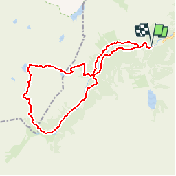

Length
18.6 km

Max alt
2434 m

Uphill gradient
1012 m
Km-Effort
32 km

Min alt
1497 m

Downhill gradient
1020 m
Boucle
Yes
Creation date :
2019-01-15 13:51:57.197
Updated on :
2019-01-15 13:51:57.197
--
Difficulty : Medium

FREE GPS app for hiking
 SityTrail
IGN / Geographical institutes
SityTrail Plus
The world is yours!
About
Trail Walking of 18.6 km to be discovered at Occitania, Hautespyrenees, Cauterets. This trail is proposed by chasle.
Description
Circuit des lacs


Positioning
Country:
France
Region :
Occitania
Department/Province :
Hautespyrenees
Municipality :
Cauterets
Location:
Unknown
Start:(Dec)
Start:(UTM)
733658 ; 4748237 (30T) N.
Comments