Trail Mountain bike Revel - Canal du Midi - Revel --> Alzeau - Photo

Canal du Midi - Revel --> Alzeau

 tracegps
tracegps

User

© OpenStreetMap contributors
Length
Length
35 km
Max alt
Max alt
684 m
Uphill gradient
Uphill gradient
944 m
Km-Effort
Km-Effort  
46 km
Min alt
Min alt
227 m
Downhill gradient
Downhill gradient
506 m
Boucle
Boucle
No
Creation date :
2014-12-10 00:00:00.0
Updated on :
2014-12-10 00:00:00.0

(0 Reviews)

Mountain bike
Mountain bike
3h30
Difficulty : Very difficult

Scan this QR Code to open this trail in the SityTrail application

FREE GPS app for hiking

Logo SityTrail SityTrail

IGN / Geographical institutes

Download SityTrail from the App Store Download SityTrail from Google Play

Logo SityTrail SityTrail World

The world is yours!

Download SityTrail from the App Store Download SityTrail from Google Play Download SityTrail on Huawei AppGallery

About

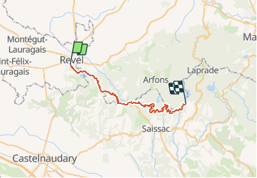
Trail Mountain bike of 35 km to be discovered at Occitania, Haute-Garonne, Revel. This trail is proposed by tracegps.

Description

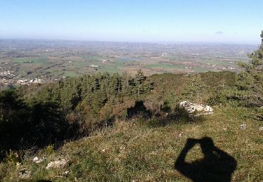
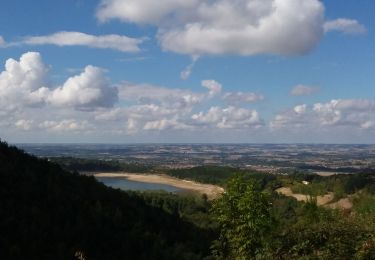
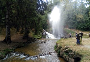
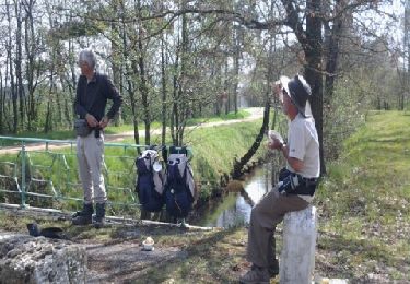
Circuit découverte du Canal du Midi. Circuit "la rigole de la Montagne" Dénivelé positif 550m environ D'autres informations disponibles chez les Randoactifs.

Elevation profile

Points of interest

Point of interest Saissac - L Lampy - Photo
tracegps
SAISSAC 
Point of interest Les Cammazes - L Cammazes - Photo
tracegps
LES CAMMAZES 
Point of interest Les Cammazes - P Cammazes - Photo
tracegps
LES CAMMAZES 
Point of interest Lacombe - Alzeau - Photo
tracegps
LACOMBE 
Point of interest Arfons - Galaube - Photo
tracegps
ARFONS 

Positioning

Country:
France
Region :
Occitania
Department/Province :
Haute-Garonne
Municipality :
Revel
Location:
Unknown
Start:(UTM)
419388 ; 4811447 (31T) N.

Trails nearby

Trail Walking Revel - Revel Saint Férréol en boucle - Photo
Walking
christian425

Walking

Easy
(2)
Revel, Occitania, Haute-Garonne, France
10.4 km | 13.3 km-effort
3h 16min
Yes
Trail Mountain bike Revel - Revel.vol à voile st ferreok  - Photo
Mountain bike
leroj73

Mountain bike

Very easy
(1)
Revel, Occitania, Haute-Garonne, France
28 km | 36 km-effort
1h 49min
Yes
Trail Running Revel - Desperado Trail 31km - Photo
Running
ycuiller

Running

Medium
(1)
Revel, Occitania, Haute-Garonne, France
31 km | 46 km-effort
3h 0min
No
Trail Mountain bike Sorèze - 2012-04-01cammazes - Photo
Mountain bike
Arpones

Mountain bike

Difficult
(1)
Sorèze, Occitania, Tarn, France
49 km | 63 km-effort
3h 17min
Yes
Trail Walking Les Brunels - Boucle entre le Lac de Saint Ferréol et la Lac des Cammazes - Photo
Walking
tercla

Walking

Difficult
Les Brunels, Occitania, Aude, France
19.8 km | 28 km-effort
4h 58min
Yes
Trail On foot Revel - Tour du Lac - Photo
On foot
PRO

On foot

Easy
Revel, Occitania, Haute-Garonne, France
4.3 km | 4.8 km-effort
1h 5min
Yes
Trail Cycle Sorèze - De Revel à Mazamet - Photo
Cycle
tracegps

Cycle

Medium
(1)
Sorèze, Occitania, Tarn, France
62 km | 77 km-effort
4h 0min
No
Trail Walking Revel - Revel - Les Cassés - Photo
Walking
RR31

Walking

Medium
Revel, Occitania, Haute-Garonne, France
22 km | 24 km-effort
1min
No
Trail Other activity Sorèze - soreze - Photo
Other activity
cazeaux

Other activity

Very easy
Sorèze, Occitania, Tarn, France
23 km | 33 km-effort
3h 46min
Yes


Close
My subscriptions