Trail Walking Olmi-Cappella - Monte Corona - Photo
 tracegps
tracegps

User

© OpenStreetMap contributors
Length
Length
10 km
Max alt
Max alt
2132 m
Uphill gradient
Uphill gradient
988 m
Km-Effort
Km-Effort  
23 km
Min alt
Min alt
1184 m
Downhill gradient
Downhill gradient
997 m
Boucle
Boucle
Yes
Creation date :
2014-12-10 00:00:00.0
Updated on :
2014-12-10 00:00:00.0

(1 Reviews)

Walking
Walking
8h00
Difficulty : Very difficult

Scan this QR Code to open this trail in the SityTrail application

FREE GPS app for hiking

Logo SityTrail SityTrail

IGN / Geographical institutes

Download SityTrail from the App Store Download SityTrail from Google Play

Logo SityTrail SityTrail World

The world is yours!

Download SityTrail from the App Store Download SityTrail from Google Play Download SityTrail on Huawei AppGallery

About

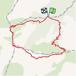
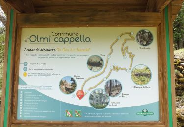
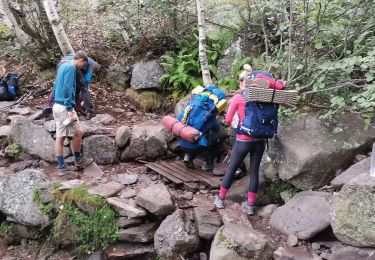
Trail Walking of 10 km to be discovered at Corsica, Haute-Corse, Olmi-Cappella. This trail is proposed by tracegps.

Description

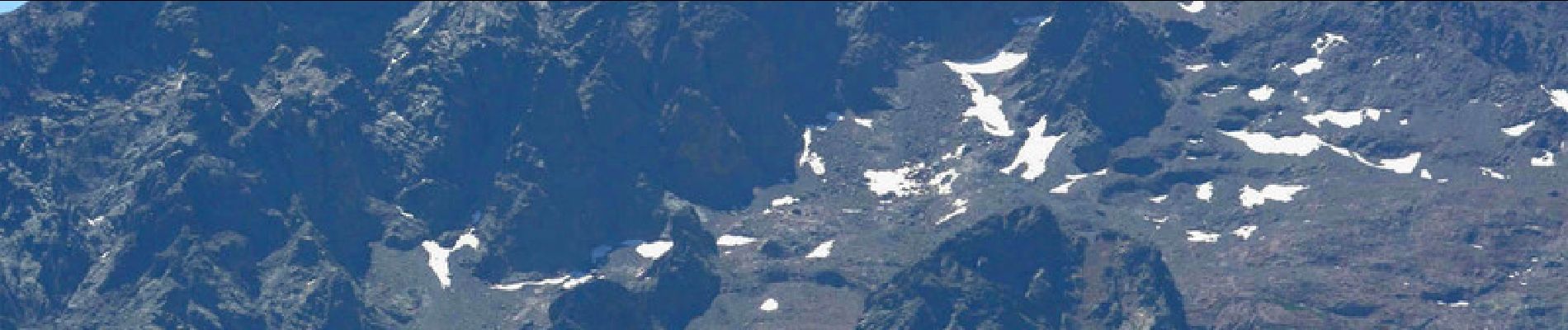
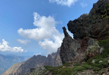
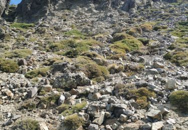
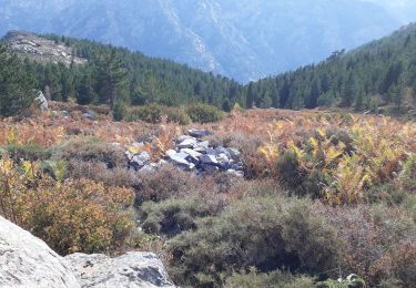
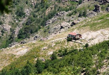
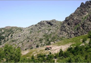
Monte Corona : un incroyable belvédère très peu fréquenté dominant Calvi et son golfe ! En prime ce sommet fait face à la grande ligne de crête comprenant Monte Cinto… La boucle telle que reproduite ici comporte un tronçon hors sentier entre le sommet et le col de l’Ondella : un aller retour au sommet par le col de Tartagine, avec un dénivelé inférieur à 1000 mètres est une option plus facile. Tous les détails de la rando avec de nombreuses photos ici

Elevation profile

Photos

Points of interest

Point of interest Asco - Col de l'Ondella - Photo
tracegps
Point of interest Calenzana - Col de Tartagine - Photo
tracegps
CALENZANA 
Point of interest Olmi-Cappella - Monte Corona - Photo
tracegps
OLMI-CAPPELLA 
Point of interest Olmi-Cappella - Ruisseau de Calanca - Photo
tracegps
OLMI-CAPPELLA 
Point of interest Olmi-Cappella - Ruisseau de Tartagine - Photo
tracegps
OLMI-CAPPELLA 

Positioning

Country:
France
Region :
Corsica
Department/Province :
Haute-Corse
Municipality :
Olmi-Cappella
Location:
Unknown
Start:(UTM)
494977 ; 4702142 (32T) N.

Comments

Please log in to post a review or rate the element


Très bonne application, avec beaucoup de possibilités, montagnard, je l'utilise !!!


Trails nearby

Trail Walking Calenzana - Ortu di u piobbu. Carozzu - Photo
Walking
GUIDE
Roger Philippe Wallez

Walking

Difficult
Calenzana, Corsica, Haute-Corse, France
8.3 km | 18.9 km-effort
7h 3min
No
Trail Walking Olmi-Cappella - Randonnée dans la forêt de Tartagine - Photo
Walking
verpoorten

Walking

Medium
(1)
Olmi-Cappella, Corsica, Haute-Corse, France
4.8 km | 7.4 km-effort
1h 32min
Yes
Trail Walking Calenzana - monte grosso, au départ de la Flatta  - Photo
Walking
casadebastia

Walking

Difficult
Calenzana, Corsica, Haute-Corse, France
8.3 km | 24 km-effort
3h 24min
No
Trail Walking Calenzana - RG20 Corse étape 2 - Photo
Walking
laurentnecca

Walking

Difficult
Calenzana, Corsica, Haute-Corse, France
5 km | 14.2 km-effort
8h 55min
No
Trail Walking Asco - monte padru - Photo
Walking
Stephane Shintu

Walking

Very easy
Asco, Corsica, Haute-Corse, France
29 km | 40 km-effort
4h 32min
No
Trail Walking Calenzana - GR 20® du refuge d'Ortu di u Piobbu au refuge de Carrozzu  - Photo
Walking
tracegps

Walking

Difficult
Calenzana, Corsica, Haute-Corse, France
6.7 km | 16.6 km-effort
7h 0min
No
Trail Walking Calenzana - GR 20® Liaison du refuge d'Ortu di u Piobbu à Bonifatu - Photo
Walking
tracegps

Walking

Medium
Calenzana, Corsica, Haute-Corse, France
6.7 km | 16.6 km-effort
2h 30min
No
Trail Walking Asco - carrou - Photo
Walking
P.Perrin

Walking

Easy
Asco, Corsica, Haute-Corse, France
3.2 km | 5.9 km-effort
1h 24min
No
Trail On foot Mausoléo - vikD1Uqzfsk - Photo
On foot
jvitus

On foot

Medium
Mausoléo, Corsica, Haute-Corse, France
15.1 km | 31 km-effort
7h 2min
Yes


Close
My subscriptions