Trail Walking Geiranger - Gairanger - Photo
 lviallet
lviallet

User

© OpenStreetMap contributors
Length
Length
7.5 km
Max alt
Max alt
298 m
Uphill gradient
Uphill gradient
508 m
Km-Effort
Km-Effort  
14.2 km
Min alt
Min alt
-1 m
Downhill gradient
Downhill gradient
501 m
Boucle
Boucle
Yes
Creation date :
2018-08-06 18:35:55.606
Updated on :
2018-08-06 18:50:18.082

(0 Reviews)

Walking
Walking
2h54
Difficulty : Very easy

Scan this QR Code to open this trail in the SityTrail application

FREE GPS app for hiking

Logo SityTrail SityTrail

IGN / Geographical institutes

Download SityTrail from the App Store Download SityTrail from Google Play

Logo SityTrail SityTrail World

The world is yours!

Download SityTrail from the App Store Download SityTrail from Google Play Download SityTrail on Huawei AppGallery

About

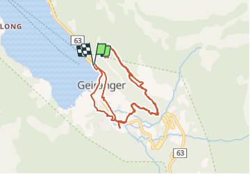
Trail Walking of 7.5 km to be discovered at Møre og Romsdal. This trail is proposed by lviallet.

Description

Faite le 06/08/18

Elevation profile

Positioning

Country:
Norway
Region :
Møre og Romsdal
Department/Province :
Møre og Romsdal
Municipality :
Geiranger
Location:
Unknown
Start:(UTM)
406281 ; 6886938 (32V) N.

Trails nearby

Trail Motor  - 11 Eidsdal- Stryn 135 - Photo
Motor
gpstracks

Motor

Very easy
, Møre og Romsdal, , Norway
96 km | 184 km-effort
Unknown
No


Close
My subscriptions