


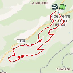
Les cascades - Prélong - Vergnes - Prapsou

tracegps
User


3h00
Difficulty : Medium

FREE GPS app for hiking
 SityTrail
IGN / Geographical institutes
SityTrail Plus
The world is yours!
About
Trail Walking of 11 km to be discovered at Auvergne-Rhône-Alpes, Cantal, Albepierre-Bredons. This trail is proposed by tracegps.
Description
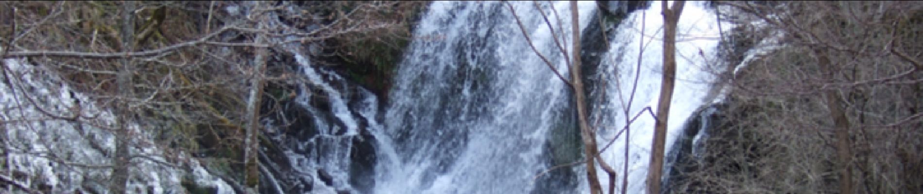
Au coeur de la Haute-Auvergne, entre Albepierre et Prat de Bouc, l'itinéraire mène à la découverte de la cascade de Prélong après un léger détour, celle des Vergnes et celle du Prapsou au retour . Attention aux abords pentus et glissants! Balade numérisée sur le terrain par Jean louis Phillipart. Retrouvez cette randonnée dans le topo Guide Chamina Volcan Cantalien.
Photos


Positioning
Comments