


Molières Cavaillac

ARVIEU
User
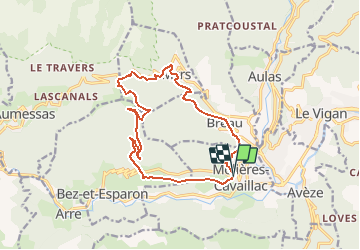

Length
15.8 km

Max alt
814 m

Uphill gradient
722 m
Km-Effort
25 km

Min alt
288 m

Downhill gradient
719 m
Boucle
Yes
Creation date :
2019-01-15 14:45:40.303
Updated on :
2019-01-15 14:45:40.303
5h00
Difficulty : Medium

FREE GPS app for hiking
 SityTrail
IGN / Geographical institutes
SityTrail Plus
The world is yours!
About
Trail Walking of 15.8 km to be discovered at Occitania, Gard, Molières-Cavaillac. This trail is proposed by ARVIEU.
Positioning
Country:
France
Region :
Occitania
Department/Province :
Gard
Municipality :
Molières-Cavaillac
Location:
Unknown
Start:(Dec)
Start:(UTM)
546179 ; 4869308 (31T) N.
Comments