


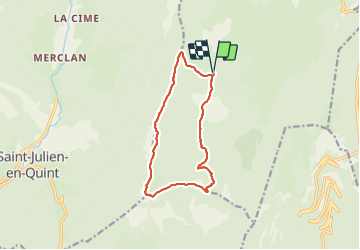
Boucle du but St Genix

viam19
User

Length
12.3 km

Max alt
1619 m

Uphill gradient
510 m
Km-Effort
19.1 km

Min alt
1252 m

Downhill gradient
510 m
Boucle
Yes
Creation date :
2018-11-19 18:18:28.496
Updated on :
2018-11-19 18:18:28.496
5h00
Difficulty : Difficult

FREE GPS app for hiking
 SityTrail
IGN / Geographical institutes
SityTrail Plus
The world is yours!
About
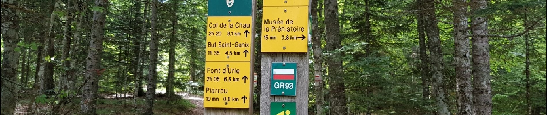
Trail Other activity of 12.3 km to be discovered at Auvergne-Rhône-Alpes, Drôme, Vassieux-en-Vercors. This trail is proposed by viam19.
Description
Randonée en boucle
Photos


Positioning
Country:
France
Region :
Auvergne-Rhône-Alpes
Department/Province :
Drôme
Municipality :
Vassieux-en-Vercors
Location:
Unknown
Start:(Dec)
Start:(UTM)
686058 ; 4970037 (31T) N.
Comments