


dôme d'eraigne

Maca8284
User
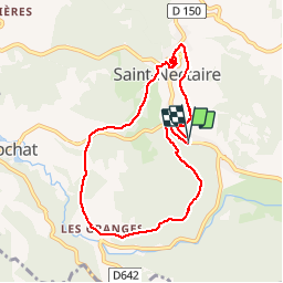

Length
8.6 km

Max alt
819 m

Uphill gradient
264 m
Km-Effort
12.2 km

Min alt
678 m

Downhill gradient
271 m
Boucle
Yes
Creation date :
2019-01-15 14:58:08.04
Updated on :
2019-01-15 14:58:08.04
2h42
Difficulty : Easy

FREE GPS app for hiking
 SityTrail
IGN / Geographical institutes
SityTrail Plus
The world is yours!
About
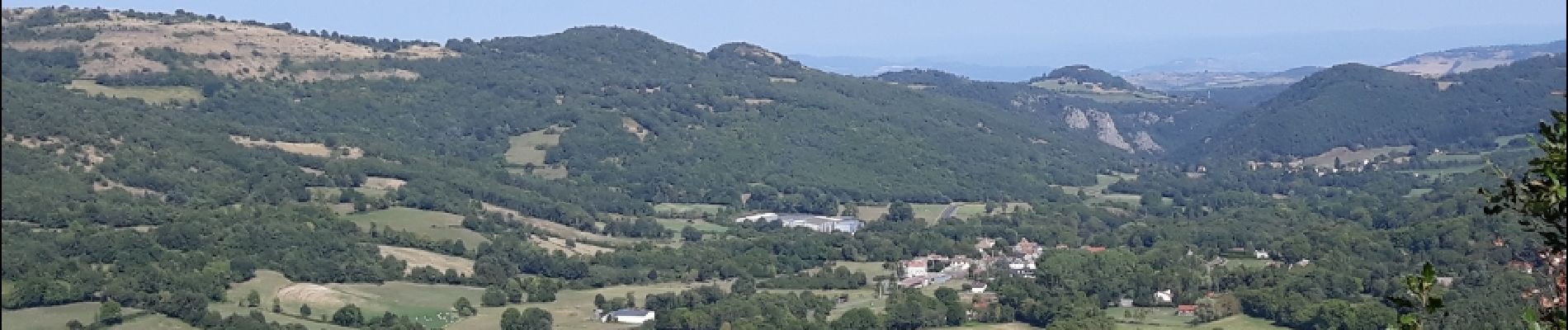
Trail Walking of 8.6 km to be discovered at Auvergne-Rhône-Alpes, Puy-de-Dôme, Saint-Nectaire. This trail is proposed by Maca8284.
Description
super jolie et agréable en forêt
Photos


Positioning
Country:
France
Region :
Auvergne-Rhône-Alpes
Department/Province :
Puy-de-Dôme
Municipality :
Saint-Nectaire
Location:
Unknown
Start:(Dec)
Start:(UTM)
499588 ; 5047295 (31T) N.
Comments