


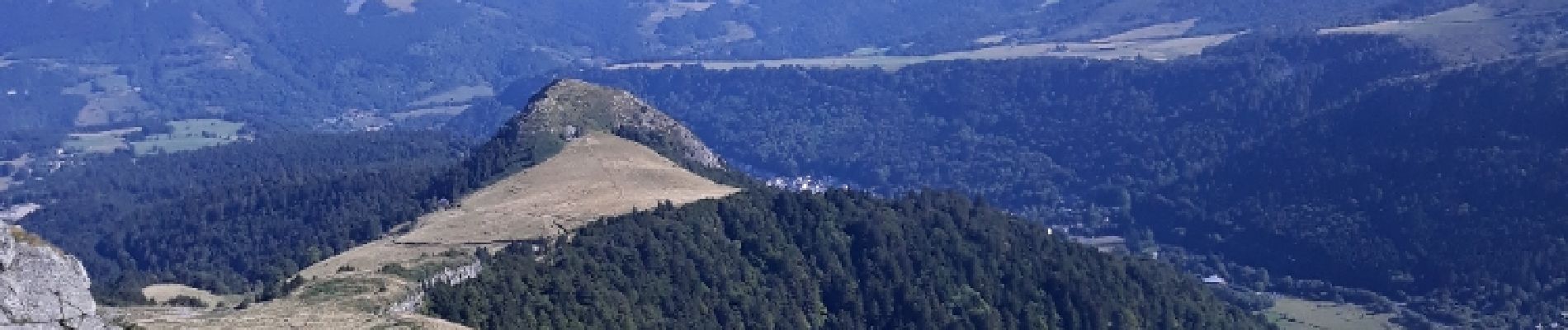
puy de sancy

Maca8284
User
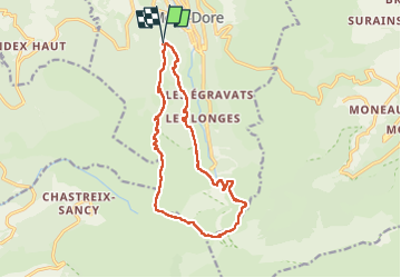

Length
14.7 km

Max alt
1862 m

Uphill gradient
737 m
Km-Effort
25 km

Min alt
1216 m

Downhill gradient
737 m
Boucle
Yes
Creation date :
2019-01-15 15:00:18.705
Updated on :
2019-01-15 15:00:18.705
5h32
Difficulty : Difficult

FREE GPS app for hiking
 SityTrail
IGN / Geographical institutes
SityTrail Plus
The world is yours!
About
Trail Walking of 14.7 km to be discovered at Auvergne-Rhône-Alpes, Puy-de-Dôme, Mont-Dore. This trail is proposed by Maca8284.
Description
moyen
Photos


Positioning
Country:
France
Region :
Auvergne-Rhône-Alpes
Department/Province :
Puy-de-Dôme
Municipality :
Mont-Dore
Location:
Unknown
Start:(Dec)
Start:(UTM)
484542 ; 5046285 (31T) N.
Comments