


180822 vélo

benoit48
User
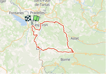

Length
59 km

Max alt
1432 m

Uphill gradient
952 m
Km-Effort
72 km

Min alt
903 m

Downhill gradient
951 m
Boucle
Yes
Creation date :
2019-01-15 15:05:36.725
Updated on :
2019-05-08 17:18:55.739
--
Difficulty : Unknown

FREE GPS app for hiking
 SityTrail
IGN / Geographical institutes
SityTrail Plus
The world is yours!
About
Trail Cycle of 59 km to be discovered at Occitania, Lozère, Langogne. This trail is proposed by benoit48.
Positioning
Country:
France
Region :
Occitania
Department/Province :
Lozère
Municipality :
Langogne
Location:
Unknown
Start:(Dec)
Start:(UTM)
568113 ; 4953222 (31T) N.
Comments