


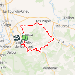


22 km | 29 km-effort


User


FREE GPS app for hiking
 SityTrail
IGN / Geographical institutes
SityTrail World
The world is yours!
Trail Mountain bike of 24 km to be discovered at Occitania, Ariège, Saint-Félix-de-Rieutord. This trail is proposed by tracegps.
Bosse du Plantaurel FFC VTT Circuit n° 7 Aux portes de l’ANDORRE, au pied des Pyrénées, entre FOIX et PAMIERS, les Bosses du Plantaurel - site label VTT – FFC situé sur le massif du même nom, offre une diversité de paysages, de faune et de flore dans un relief accidenté intéressant à découvrir. Relevé terrain par lesVttayres du Sabarthés.
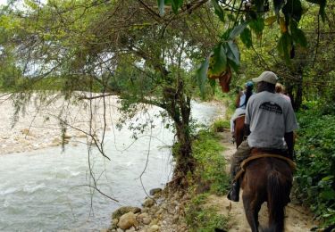
Equestrian

Cycle
Mountain bike
Mountain bike
Mountain bike
Road bike

Running

Walking