Trail Walking Eccica-Suarella - Trail de Sampiero - Photo
 tracegps
tracegps

User

© OpenStreetMap contributors
Length
Length
12.2 km
Max alt
Max alt
505 m
Uphill gradient
Uphill gradient
641 m
Km-Effort
Km-Effort  
21 km
Min alt
Min alt
116 m
Downhill gradient
Downhill gradient
641 m
Boucle
Boucle
Yes
Creation date :
2014-12-10 00:00:00.0
Updated on :
2014-12-10 00:00:00.0

(1 Reviews)

Walking
Walking
3h30
Difficulty : Medium

Scan this QR Code to open this trail in the SityTrail application

FREE GPS app for hiking

Logo SityTrail SityTrail

IGN / Geographical institutes

Download SityTrail from the App Store Download SityTrail from Google Play

Logo SityTrail SityTrail World

The world is yours!

Download SityTrail from the App Store Download SityTrail from Google Play Download SityTrail on Huawei AppGallery

About

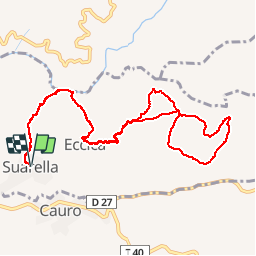
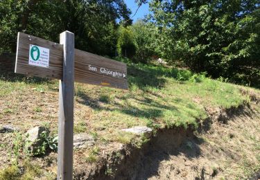
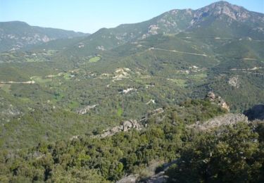
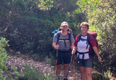
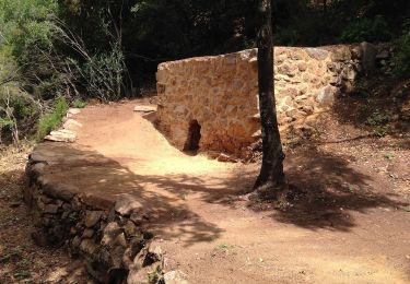
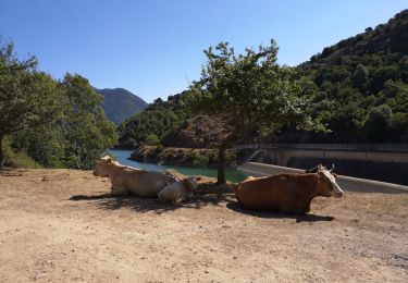
Trail Walking of 12.2 km to be discovered at Corsica, South Corsica, Eccica-Suarella. This trail is proposed by tracegps.

Description

Parcours de 12km de moyenne montagne avec un dénivelé positif de 750m. Le terrain est souple et en majeure partie en sous-bois. Quelques beaux points de vue sur le village et au loin le golfe d'Ajaccio.

Elevation profile

Photos

Positioning

Country:
France
Region :
Corsica
Department/Province :
South Corsica
Municipality :
Eccica-Suarella
Location:
Unknown
Start:(Dec)
Start:(UTM)
492330 ; 4641228 (32T) N.

Comments

Please log in to post a review or rate the element


superbe, avec de l'ombre!


Trails nearby

Trail Walking Cauro - Arche de CAURO - Photo
Walking
cathymac20

Walking

Easy
(3)
Cauro, Corsica, South Corsica, France
3.9 km | 6.2 km-effort
2h 47min
Yes
Trail Mountain bike Cauro - vtt cauro accelasca piste ruppione et retour - Photo
Mountain bike
Orsu Vincenti

Mountain bike

Medium
Cauro, Corsica, South Corsica, France
47 km | 56 km-effort
2h 57min
No
Trail Walking Eccica-Suarella - Cauro, de Pian di veccia jusqu'au Prunu - Photo
Walking
daisychain

Walking

Medium
Eccica-Suarella, Corsica, South Corsica, France
5 km | 9.2 km-effort
2h 6min
No
Trail Walking Grosseto-Prugna - Ma Mare a Mare centre étape 2: du col St Georges vers Quasquara - Photo
Walking
Vadim

Walking

Difficult
Grosseto-Prugna, Corsica, South Corsica, France
14.6 km | 25 km-effort
5h 1min
No
Trail Running Eccica-Suarella - Trail de Sampiero - Photo
Running
tracegps

Running

Medium
(1)
Eccica-Suarella, Corsica, South Corsica, France
12.2 km | 21 km-effort
2h 0min
Yes
Trail Walking Cauro - cauro col st Antoine  - Photo
Walking
supernini2a

Walking

Very easy
(1)
Cauro, Corsica, South Corsica, France
11 km | 16.2 km-effort
3h 37min
Yes
Trail Walking Grosseto-Prugna - Mar A Mar sixième jour - Photo
Walking
ezola

Walking

Very difficult
(1)
Grosseto-Prugna, Corsica, South Corsica, France
18.5 km | 25 km-effort
5h 0min
No
Trail On foot Cuttoli-Corticchiato - Monte Aragnascu - Photo
On foot
PRO

On foot

Easy
Cuttoli-Corticchiato, Corsica, South Corsica, France
8.1 km | 13.1 km-effort
2h 58min
No
Trail Walking Tolla - lac de Tolla  - Photo
Walking
fchavet

Walking

Medium
Tolla, Corsica, South Corsica, France
4.8 km | 6.7 km-effort
44min
No


Close
My subscriptions