


Val Louron 13, Cap de Toudous

octo
User
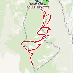

Length
12.2 km

Max alt
2254 m

Uphill gradient
842 m
Km-Effort
23 km

Min alt
1442 m

Downhill gradient
845 m
Boucle
Yes
Creation date :
2018-08-26 18:36:06.664
Updated on :
2018-08-26 18:36:06.664
3h41
Difficulty : Unknown

FREE GPS app for hiking
 SityTrail
IGN / Geographical institutes
SityTrail Plus
The world is yours!
About
Trail Walking of 12.2 km to be discovered at Occitania, Hautespyrenees, Génos. This trail is proposed by octo.
Positioning
Country:
France
Region :
Occitania
Department/Province :
Hautespyrenees
Municipality :
Génos
Location:
Unknown
Start:(Dec)
Start:(UTM)
286488 ; 4740944 (31T) N.
Comments