


Frejerolle

jpipacific
User

Length
9.4 km

Max alt
317 m

Uphill gradient
131 m
Km-Effort
11.1 km

Min alt
255 m

Downhill gradient
134 m
Boucle
Yes
Creation date :
2019-01-15 15:19:01.137
Updated on :
2019-01-15 15:19:01.137
1h53
Difficulty : Easy

FREE GPS app for hiking
 SityTrail
IGN / Geographical institutes
SityTrail Plus
The world is yours!
About
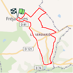
Trail Walking of 9.4 km to be discovered at Occitania, Tarn, Fréjairolles. This trail is proposed by jpipacific.
Description
Randonnée plutôt jolie avec alternance de sous bois, de points de vue dominants, de chemins et de petites routes. A noter: Pas de chien qui aboie tout le long de la randonnée. Chemin bien balisé.
Positioning
Country:
France
Region :
Occitania
Department/Province :
Tarn
Municipality :
Fréjairolles
Location:
Unknown
Start:(Dec)
Start:(UTM)
438321 ; 4858912 (31T) N.
Comments