


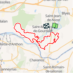
AIN BAIGNADE 30K

ophness
User

Length
30 km

Max alt
221 m

Uphill gradient
190 m
Km-Effort
33 km

Min alt
184 m

Downhill gradient
191 m
Boucle
Yes
Creation date :
2019-01-15 15:31:18.359
Updated on :
2019-01-15 15:31:18.359
9h27
Difficulty : Unknown

FREE GPS app for hiking
 SityTrail
IGN / Geographical institutes
SityTrail Plus
The world is yours!
About
Trail Other activity of 30 km to be discovered at Auvergne-Rhône-Alpes, Ain, Loyettes. This trail is proposed by ophness.
Positioning
Country:
France
Region :
Auvergne-Rhône-Alpes
Department/Province :
Ain
Municipality :
Loyettes
Location:
Unknown
Start:(Dec)
Start:(UTM)
671902 ; 5075845 (31T) N.
Comments