


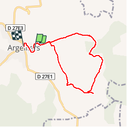
Argelliers

Ajax44
User

Length
7.7 km

Max alt
234 m

Uphill gradient
136 m
Km-Effort
9.5 km

Min alt
170 m

Downhill gradient
106 m
Boucle
No
Creation date :
2019-01-15 15:38:57.53
Updated on :
2019-01-15 15:38:57.53
2h03
Difficulty : Easy

FREE GPS app for hiking
 SityTrail
IGN / Geographical institutes
SityTrail Plus
The world is yours!
About
Trail Walking of 7.7 km to be discovered at Occitania, Hérault, Argelliers. This trail is proposed by Ajax44.
Positioning
Country:
France
Region :
Occitania
Department/Province :
Hérault
Municipality :
Argelliers
Location:
Unknown
Start:(Dec)
Start:(UTM)
554595 ; 4838618 (31T) N.
Comments