Trail Walking Gragnague - Le Tour de Gragnague - Photo

Le Tour de Gragnague

 tracegps
tracegps

User

© OpenStreetMap contributors
Length
Length
8.8 km
Max alt
Max alt
156 m
Uphill gradient
Uphill gradient
57 m
Km-Effort
Km-Effort  
9.5 km
Min alt
Min alt
139 m
Downhill gradient
Downhill gradient
57 m
Boucle
Boucle
Yes
Creation date :
2014-12-10 00:00:00.0
Updated on :
2014-12-10 00:00:00.0

(0 Reviews)

Walking
Walking
1h45
Difficulty : Medium

Scan this QR Code to open this trail in the SityTrail application

FREE GPS app for hiking

Logo SityTrail SityTrail

IGN / Geographical institutes

Download SityTrail from the App Store Download SityTrail from Google Play

Logo SityTrail SityTrail World

The world is yours!

Download SityTrail from the App Store Download SityTrail from Google Play Download SityTrail on Huawei AppGallery

About

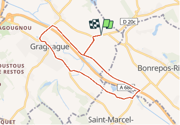
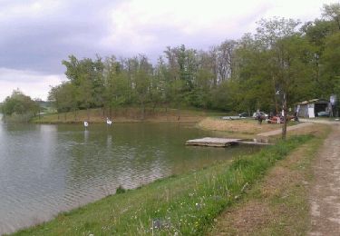
Trail Walking of 8.8 km to be discovered at Occitania, Haute-Garonne, Gragnague. This trail is proposed by tracegps.

Description

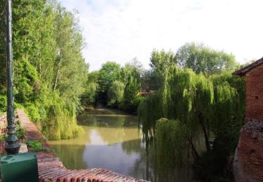
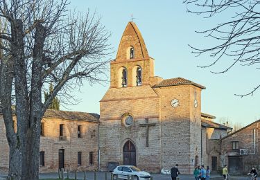
Balade le long des berges du Girou par le village de Gragnague. Selon les Gragnaguais le nom Gragnague provient de la grenouille, dont elle était la vedette lors de la fête à la grenouille aujourd'hui remplacée par la fête de la châtaigne. (source Wikipédia) A cette occasion, fin octobre, est organisé un des plus importants vide greniers de la région.

Elevation profile

Photos

Positioning

Country:
France
Region :
Occitania
Department/Province :
Haute-Garonne
Municipality :
Gragnague
Location:
Unknown
Start:(UTM)
387319 ; 4837800 (31T) N.

Trails nearby

Trail Walking Saint-Marcel-Paulel - Les sentiers de Saint Marcel Paulel - Photo
Walking
tracegps

Walking

Medium
(2)
Saint-Marcel-Paulel, Occitania, Haute-Garonne, France
8.7 km | 10.1 km-effort
2h 0min
Yes
Trail Walking Gragnague - Tour de Bonrepos Riquet - Photo
Walking
tracegps

Walking

Medium
(1)
Gragnague, Occitania, Haute-Garonne, France
9.7 km | 11.6 km-effort
2h 0min
Yes
Trail Cycle Garidech - Vélo route Garidech 46km - Photo
Cycle
tracegps

Cycle

Medium
(1)
Garidech, Occitania, Haute-Garonne, France
46 km | 51 km-effort
2h 0min
Yes
Trail On foot Gragnague - La rondes des berges - Photo
On foot
PRO

On foot

Easy
Gragnague, Occitania, Haute-Garonne, France
7.9 km | 8.5 km-effort
1h 55min
Yes
Trail Walking Verfeil - tour du lac du laragou - Photo
Walking
christian425

Walking

Easy
Verfeil, Occitania, Haute-Garonne, France
5.1 km | 5.7 km-effort
1h 7min
Yes
Trail Walking Verfeil - Le tour du lac de Laragou - Photo
Walking
tracegps

Walking

Easy
Verfeil, Occitania, Haute-Garonne, France
4.8 km | 5.4 km-effort
1h 45min
Yes
Trail Running Saint-Marcel-Paulel - Les sentiers de Saint Marcel Paulel - Photo
Running
tracegps

Running

Medium
Saint-Marcel-Paulel, Occitania, Haute-Garonne, France
8.7 km | 10.1 km-effort
1h 0min
Yes
Trail Running Verfeil - De Verfeil à la Balerme - Photo
Running
tracegps

Running

Difficult
Verfeil, Occitania, Haute-Garonne, France
13.9 km | 17.8 km-effort
1h 30min
Yes
Trail Mountain bike Verfeil - De Verfeil à la Balerme - Photo
Mountain bike
tracegps

Mountain bike

Medium
Verfeil, Occitania, Haute-Garonne, France
13.9 km | 17.8 km-effort
1h 10min
Yes


Close
My subscriptions