


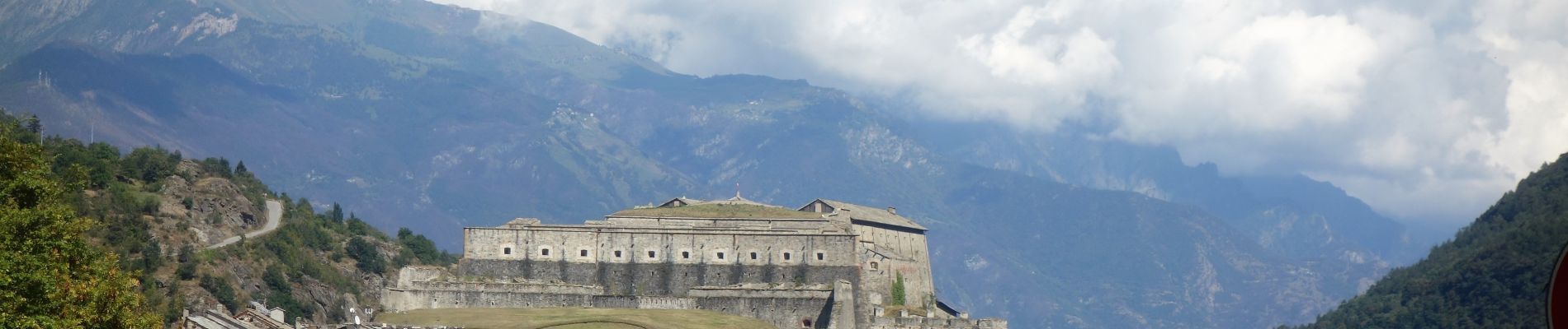
Rome_48_Gad_Chomionte_20180907

patrickdanilo
User
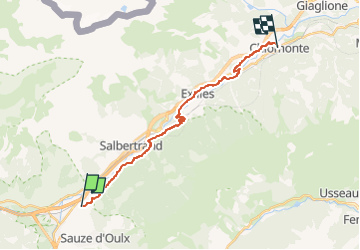

Length
18.7 km

Max alt
1215 m

Uphill gradient
765 m
Km-Effort
30 km

Min alt
654 m

Downhill gradient
1085 m
Boucle
No
Creation date :
2019-02-12 15:13:41.378
Updated on :
2022-11-26 18:29:20.912
5h59
Difficulty : Very difficult

FREE GPS app for hiking
 SityTrail
IGN / Geographical institutes
SityTrail Plus
The world is yours!
About
Trail Walking of 18.7 km to be discovered at Piemont, Torino, Oulx. This trail is proposed by patrickdanilo.
Description
Via Alta d'Arles à Vercelli
Photos


Positioning
Country:
Italy
Region :
Piemont
Department/Province :
Torino
Municipality :
Oulx
Location:
Unknown
Start:(Dec)
Start:(UTM)
330572 ; 4989874 (32T) N.
Comments