


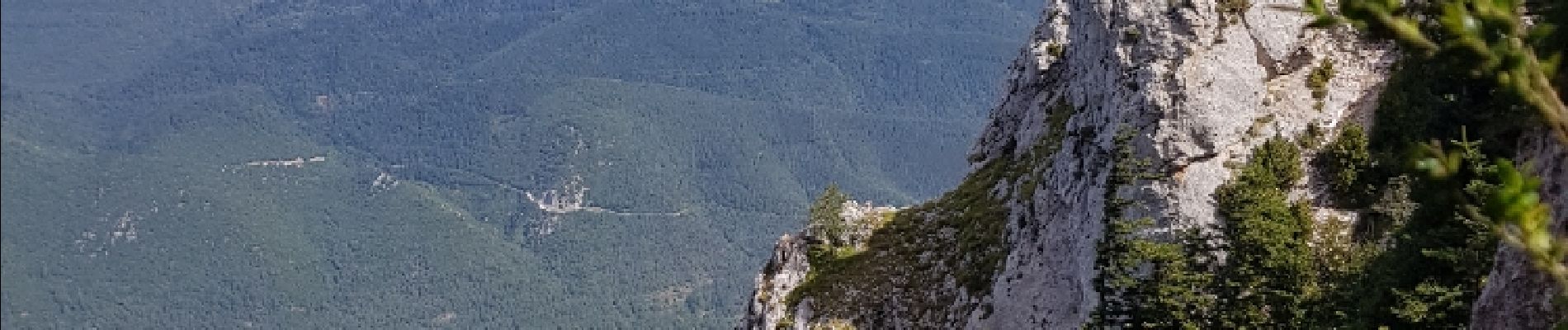
La forêt d en Malo depuis le Caunil (11)

MarieFrancoise
User
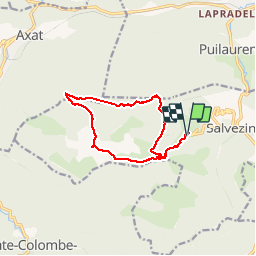

Length
13.2 km

Max alt
1460 m

Uphill gradient
689 m
Km-Effort
22 km

Min alt
852 m

Downhill gradient
698 m
Boucle
Yes
Creation date :
2019-05-27 16:39:46.548
Updated on :
2019-05-27 16:39:46.781
5h22
Difficulty : Medium

FREE GPS app for hiking
 SityTrail
IGN / Geographical institutes
SityTrail Plus
The world is yours!
About
Trail Walking of 13.2 km to be discovered at Occitania, Aude, Salvezines. This trail is proposed by MarieFrancoise.
Description
Départ après le Caunil.dans un virage garer les voitures .le sentier part sur la gauche au niveau des boïtes à lettres
jolie rando en forêt et sur les crêtes .jolis panoramas
Photos
 - Photo 1")
 - Photo 2")
 - Photo 3")
 - Photo 4")
 - Photo 5")
 - Photo 6")
 - Photo 7")
 - Photo 8")
 - Photo 9")
 - Photo 10")
 - Photo 11")
 - Photo 12")
 - Photo 13")
 - Photo 14")
 - Photo 15")


Positioning
Country:
France
Region :
Occitania
Department/Province :
Aude
Municipality :
Salvezines
Location:
Unknown
Start:(Dec)
Start:(UTM)
441888 ; 4736484 (31T) N.
Comments
faite dans le sens inverse. superbe randonnée !