Trail Walking Arfeuilles - La Pisserote - Arfeuilles - Photo

La Pisserote - Arfeuilles

 tracegps
tracegps

User

© OpenStreetMap contributors
Length
Length
14.9 km
Max alt
Max alt
685 m
Uphill gradient
Uphill gradient
506 m
Km-Effort
Km-Effort  
22 km
Min alt
Min alt
421 m
Downhill gradient
Downhill gradient
517 m
Boucle
Boucle
No
Creation date :
2014-12-10 00:00:00.0
Updated on :
2014-12-10 00:00:00.0

(1 Reviews)

Walking
Walking
4h00
Difficulty : Difficult

Scan this QR Code to open this trail in the SityTrail application

FREE GPS app for hiking

Logo SityTrail SityTrail

IGN / Geographical institutes

Download SityTrail from the App Store Download SityTrail from Google Play

Logo SityTrail SityTrail World

The world is yours!

Download SityTrail from the App Store Download SityTrail from Google Play Download SityTrail on Huawei AppGallery

About

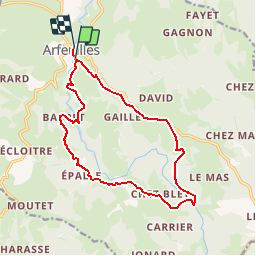
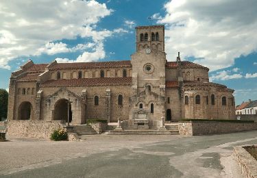
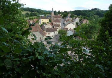
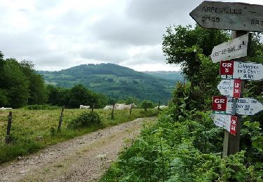
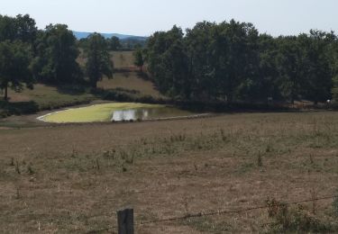
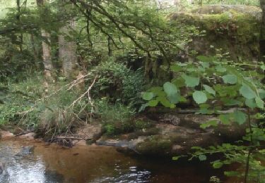
Trail Walking of 14.9 km to be discovered at Auvergne-Rhône-Alpes, Allier, Arfeuilles. This trail is proposed by tracegps.

Description

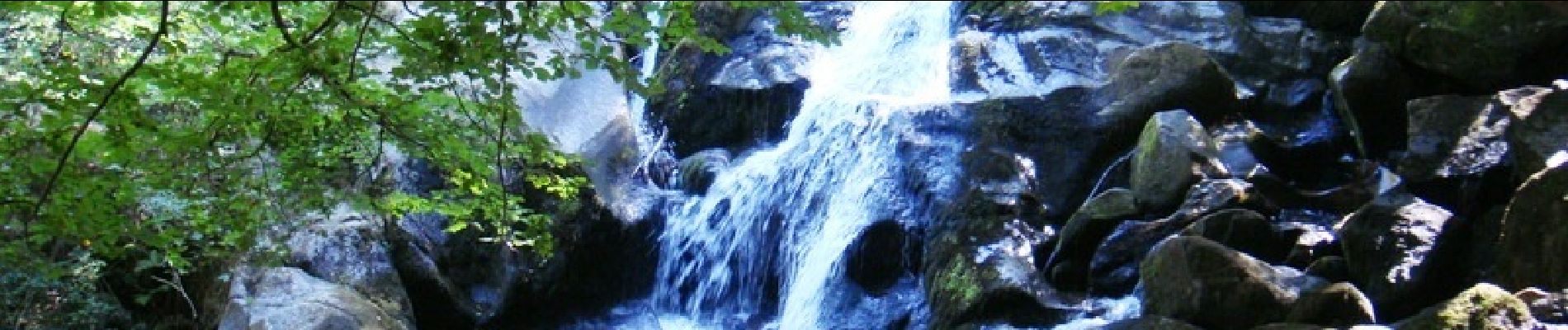
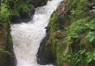
Circuit de la cascade de la Pisserote. Les photos datent de la fin de l'été. Le débit du Barbenan est bien plus important au printemps, créant de belles gerbes. Traversées de bois de hêtres à la luminosité si particulière.

Elevation profile

Photos

Positioning

Country:
France
Region :
Auvergne-Rhône-Alpes
Department/Province :
Allier
Municipality :
Arfeuilles
Location:
Unknown
Start:(UTM)
556249 ; 5111397 (31T) N.

Comments

Please log in to post a review or rate the element


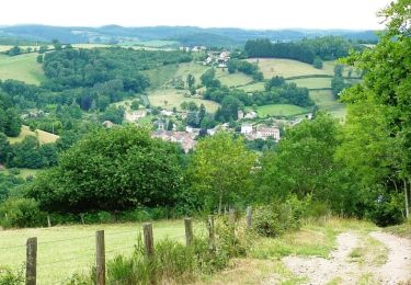
Très belle randonnée au printemps


Trails nearby

Trail Running Châtel-Montagne - jour 7 CAP Jeanot - Photo
Running
jeannat

Running

Very easy
Châtel-Montagne, Auvergne-Rhône-Alpes, Allier, France
33 km | 43 km-effort
4h 29min
No
Trail Mountain bike Arfeuilles - 8ème Randonnée de la Vallée du Barbenan (2014-VTT-54km) - Arfeuilles - Photo
Mountain bike
tracegps

Mountain bike

Very difficult
Arfeuilles, Auvergne-Rhône-Alpes, Allier, France
53 km | 74 km-effort
4h 0min
Yes
Trail Walking Châtel-Montagne - Le Puy du Roc - Châtel-Montagne - Photo
Walking
tracegps

Walking

Medium
Châtel-Montagne, Auvergne-Rhône-Alpes, Allier, France
10.2 km | 15.3 km-effort
3h 0min
Yes
Trail Mountain bike Châtelus - VTT à Châtelus - La ronde des étangs - Photo
Mountain bike
tracegps

Mountain bike

Difficult
Châtelus, Auvergne-Rhône-Alpes, Allier, France
51 km | 69 km-effort
4h 30min
Yes
Trail Mountain bike Arfeuilles - La vallée du Barbenan (VTT-2011) - Arfeuilles - Photo
Mountain bike
tracegps

Mountain bike

Very difficult
Arfeuilles, Auvergne-Rhône-Alpes, Allier, France
53 km | 77 km-effort
5h 0min
Yes
Trail Walking Arfeuilles - la cascade de pisserotte - Photo
Walking
bendoush

Walking

Easy
Arfeuilles, Auvergne-Rhône-Alpes, Allier, France
12.5 km | 16.3 km-effort
3h 34min
No
Trail Hybrid bike Châtel-Montagne - jour 7 - Photo
Hybrid bike
nathbab

Hybrid bike

Very easy
Châtel-Montagne, Auvergne-Rhône-Alpes, Allier, France
27 km | 32 km-effort
2h 6min
No
Trail Walking Arfeuilles - Arfeuilles - tour de la cascade de la Pisserotte  - Photo
Walking
coco03

Walking

Easy
Arfeuilles, Auvergne-Rhône-Alpes, Allier, France
12.8 km | 17.6 km-effort
3h 54min
Yes
Trail Walking Châtel-Montagne - Balade autour du Mont Aigu - Le Moulin Chatel - Photo
Walking
tracegps

Walking

Medium
Châtel-Montagne, Auvergne-Rhône-Alpes, Allier, France
10.4 km | 14.1 km-effort
2h 30min
Yes


Close
My subscriptions