Trail Mountain bike Ottrott - Boucle de Otrott au Mont St Odile - Photo

Boucle de Otrott au Mont St Odile

 tracegps
tracegps

User

© OpenStreetMap contributors
Length
Length
30 km
Max alt
Max alt
789 m
Uphill gradient
Uphill gradient
1154 m
Km-Effort
Km-Effort  
45 km
Min alt
Min alt
311 m
Downhill gradient
Downhill gradient
1154 m
Boucle
Boucle
Yes
Creation date :
2014-12-10 00:00:00.0
Updated on :
2014-12-10 00:00:00.0

(0 Reviews)

Mountain bike
Mountain bike
3h45
Difficulty : Difficult

Scan this QR Code to open this trail in the SityTrail application

FREE GPS app for hiking

Logo SityTrail SityTrail

IGN / Geographical institutes

Download SityTrail from the App Store Download SityTrail from Google Play

Logo SityTrail SityTrail World

The world is yours!

Download SityTrail from the App Store Download SityTrail from Google Play Download SityTrail on Huawei AppGallery

About

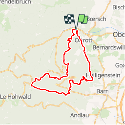
Trail Mountain bike of 30 km to be discovered at Grand Est, Bas-Rhin, Ottrott. This trail is proposed by tracegps.

Description

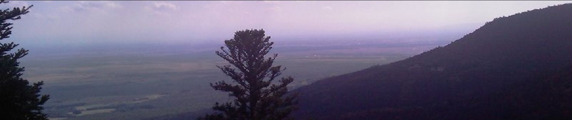
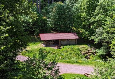
Le circuit n'est pas très long mais très varié tant par les dénivelés que par la technique. De nombreuses vues dont il n'est pas possible de décrire autrement qu'en s'y rendant par soi même. En un mot, c'est un parcours magnifique !!

Elevation profile

Photos

Positioning

Country:
France
Region :
Grand Est
Department/Province :
Bas-Rhin
Municipality :
Ottrott
Location:
Unknown
Start:(Dec)
Start:(UTM)
382677 ; 5369335 (32U) N.

Trails nearby

Trail Walking Ottrott - Le circuit sud du Mur Païen - Photo
Walking
VacheKiri67

Walking

Easy
(2)
Ottrott, Grand Est, Bas-Rhin, France
4.9 km | 6.3 km-effort
1h 56min
No
Trail Walking Ottrott - Le circuit nord du Mur Païen - Photo
Walking
VacheKiri67

Walking

Easy
(1)
Ottrott, Grand Est, Bas-Rhin, France
5.9 km | 8.5 km-effort
2h 4min
No
Trail Walking Ottrott - Le Mont Sainte-Odile depuis Otrott - Photo
Walking
VacheKiri67

Walking

Medium
(1)
Ottrott, Grand Est, Bas-Rhin, France
13 km | 20 km-effort
6h 18min
Yes
Trail Walking Ottrott - Montée vers le Mont Sainte-Odile - Photo
Walking
VacheKiri67

Walking

Difficult
(1)
Ottrott, Grand Est, Bas-Rhin, France
17.6 km | 26 km-effort
5h 52min
Yes
Trail Walking Ottrott - Le mur païen - Photo
Walking
VacheKiri67

Walking

Medium
(4)
Ottrott, Grand Est, Bas-Rhin, France
10.5 km | 14.5 km-effort
4h 36min
Yes
Trail Walking Ottrott - Mur Paien complet - Photo
Walking
markrei

Walking

Medium
(1)
Ottrott, Grand Est, Bas-Rhin, France
12 km | 16.4 km-effort
5h 25min
Yes
Trail Mountain bike Barr - Circuit des 3 Petits Ponts - Photo
Mountain bike
tracegps

Mountain bike

Difficult
(1)
Barr, Grand Est, Bas-Rhin, France
15.9 km | 22 km-effort
1h 19min
Yes
Trail Mountain bike Ottrott - Sainte-Odile East-Face - Photo
Mountain bike
tracegps

Mountain bike

Difficult
(1)
Ottrott, Grand Est, Bas-Rhin, France
24 km | 39 km-effort
3h 0min
Yes
Trail Horseback riding Mollkirch - 2023-05-28 Picnic CVA Cabane des 5 routes - Photo
Horseback riding
GUIDE
holtzv

Horseback riding

Medium
Mollkirch, Grand Est, Bas-Rhin, France
36 km | 51 km-effort
6h 39min
Yes


Close
My subscriptions