


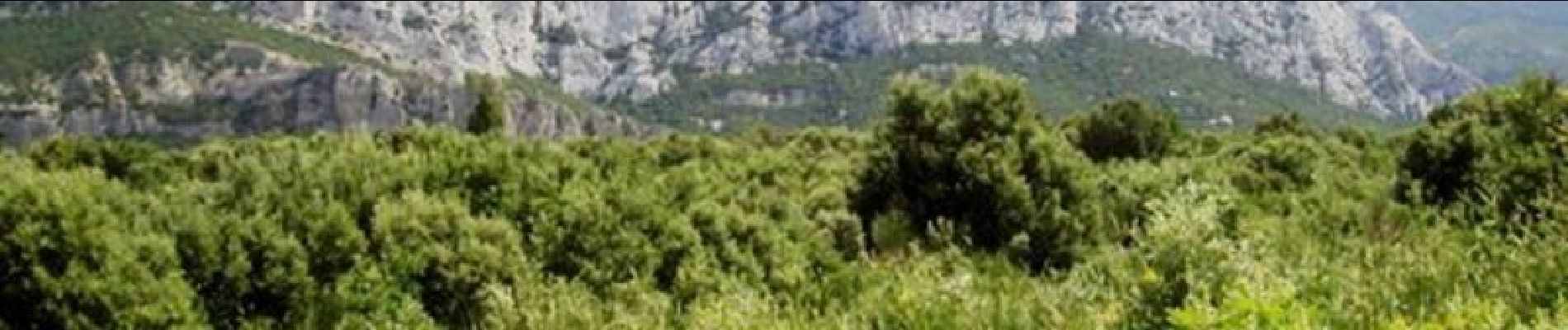
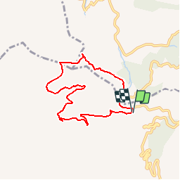
Col de l'Espigoulier Tête Roussargue

tracegps
User


2h10
Difficulty : Medium

FREE GPS app for hiking
 SityTrail
IGN / Geographical institutes
SityTrail Plus
The world is yours!
About
Trail Walking of 7.5 km to be discovered at Provence-Alpes-Côte d'Azur, Bouches-du-Rhône, Gémenos. This trail is proposed by tracegps.
Description
Vous vous garerez au col de l'Espigoulier et partirez sur une piste DFCI. Vous passerez à la bergerie de Tuny et remonterez en passant près de la tête Roussargue. Vous monterez un petit sentier (assez raide, seule difficulté de la randonnée) pour rejoindre la route et retourner à votre véhicule. Au passage vous pourrez admirer de magnifiques paysages. Points de vue sur Marseille, Aubagne, les chaines de l'Etoile, de la Sainte Victoire, la Sainte Baume, Le Garlaban... D’autres informations sur le site de Rando Loisirs à Carnoux en Provence.
Photos

Positioning
Comments