


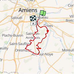

24 km | 28 km-effort


User


FREE GPS app for hiking
 SityTrail
IGN / Geographical institutes
SityTrail World
The world is yours!
Trail Mountain bike of 44 km to be discovered at Hauts-de-France, Somme, Longueau. This trail is proposed by tracegps.
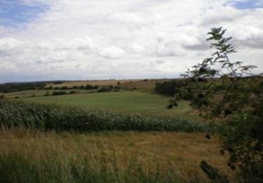
Ce parcours traverse le bois de Fau Timon, le bois Magneux (GR, puis le bois du roi,. on tournera autour d'Estrée sur Noye, puis un beau petit sentier sur Grattepanche. On passe par le bois de Camont, sains en Amiénois et le bois du Cambos. Il y a le balisage du GR depuis le château de Boves jusqu'au bois du roi.


Walking

Mountain bike
On foot
On foot
Electric bike
Motor
Walking

Walking
Mountain bike