


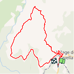
Tour des Aiguilles de Bavella

patbt
User

Length
13.6 km

Max alt
1730 m

Uphill gradient
889 m
Km-Effort
25 km

Min alt
1009 m

Downhill gradient
884 m
Boucle
Yes
Creation date :
2019-01-15 16:07:19.831
Updated on :
2019-01-15 16:07:19.831
7h29
Difficulty : Difficult

FREE GPS app for hiking
 SityTrail
IGN / Geographical institutes
SityTrail Plus
The world is yours!
About
Trail Walking of 13.6 km to be discovered at Corsica, South Corsica, Zonza. This trail is proposed by patbt.
Positioning
Country:
France
Region :
Corsica
Department/Province :
South Corsica
Municipality :
Zonza
Location:
Unknown
Start:(Dec)
Start:(UTM)
518431 ; 4626603 (32T) N.
Comments