Trail Mountain bike Rombas - Le petit huit en forêt entre Clouange, Ranguevaux et Fameck - Photo

Le petit huit en forêt entre Clouange, Ranguevaux et Fameck

 tracegps
tracegps

User

© OpenStreetMap contributors
Length
Length
29 km
Max alt
Max alt
377 m
Uphill gradient
Uphill gradient
630 m
Km-Effort
Km-Effort  
38 km
Min alt
Min alt
163 m
Downhill gradient
Downhill gradient
630 m
Boucle
Boucle
Yes
Creation date :
2014-12-10 00:00:00.0
Updated on :
2014-12-10 00:00:00.0

(2 Reviews)

Mountain bike
Mountain bike
1h30
Difficulty : Medium

Scan this QR Code to open this trail in the SityTrail application

FREE GPS app for hiking

Logo SityTrail SityTrail

IGN / Geographical institutes

Download SityTrail from the App Store Download SityTrail from Google Play

Logo SityTrail SityTrail World

The world is yours!

Download SityTrail from the App Store Download SityTrail from Google Play Download SityTrail on Huawei AppGallery

About

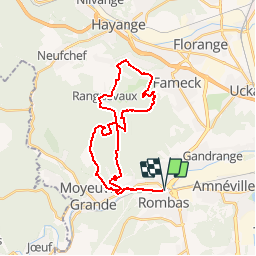
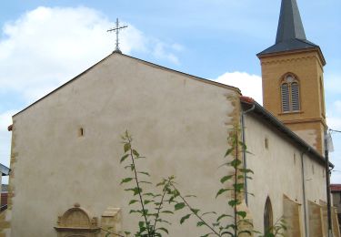
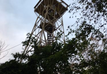
Trail Mountain bike of 29 km to be discovered at Grand Est, Moselle, Rombas. This trail is proposed by tracegps.

Description

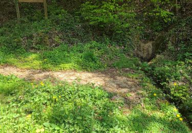
Petit circuit pour se tenir en forme comprenant de belles montées, singles tortueux et descentes techniques dans la forêt entre Clouange, Ranguevaux et Fameck.

Elevation profile

Positioning

Country:
France
Region :
Grand Est
Department/Province :
Moselle
Municipality :
Rombas
Location:
Unknown
Start:(Dec)
Start:(UTM)
288674 ; 5459905 (32U) N.

Comments

Please log in to post a review or rate the element


Trails nearby

Trail On foot Marange-Silvange - Circuit de la Croix David - Photo
On foot
PRO

On foot

Easy
Marange-Silvange, Grand Est, Moselle, France
3.8 km | 5.3 km-effort
1h 12min
No
Trail On foot Rombas - Circuit de Rombas - Photo
On foot
PRO

On foot

Easy
Rombas, Grand Est, Moselle, France
7.8 km | 10.5 km-effort
2h 23min
Yes
Trail Walking Rombas - ROMBAS - ROMBAS ET LA CÔTE DE DRINCE - Photo
Walking
jean-marie.parachini

Walking

Difficult
Rombas, Grand Est, Moselle, France
18.6 km | 27 km-effort
9h 59min
Yes
Trail Walking Rombas - Rombas Etang de Rombas et Côte de Drince - Photo
Walking
jean-marie.parachini

Walking

Difficult
Rombas, Grand Est, Moselle, France
17.8 km | 26 km-effort
10h 10min
Yes
Trail Walking Rombas - Rombas Tour de Drince - Photo
Walking
patrick57

Walking

Very easy
(1)
Rombas, Grand Est, Moselle, France
10 km | 14.4 km-effort
3h 0min
Yes
Trail Walking Moyeuvre-Grande - ferme du tremon - Photo
Walking
Cathy del vecchio

Walking

Very difficult
Moyeuvre-Grande, Grand Est, Moselle, France
15.4 km | 19.3 km-effort
4h 26min
Yes
Trail On foot Pierrevillers - Approche d'un Sentier de GR - Photo
On foot
PRO

On foot

Easy
Pierrevillers, Grand Est, Moselle, France
3.4 km | 5 km-effort
1h 8min
No
Trail On foot Rombas - Circuit de la Côte de Drince - Photo
On foot
PRO

On foot

Easy
Rombas, Grand Est, Moselle, France
5.7 km | 8.6 km-effort
1h 57min
No
Trail Other activity Gandrange - VTT tour de Drince - Photo
Other activity
SylvainSCG

Other activity

Difficult
Gandrange, Grand Est, Moselle, France
32 km | 41 km-effort
3h 8min
Yes


Close
My subscriptions