


DAMMARTIN SOUS TIGEAUX

daniel77
User
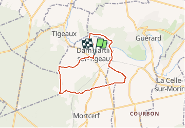

Length
12.1 km

Max alt
139 m

Uphill gradient
170 m
Km-Effort
14.4 km

Min alt
52 m

Downhill gradient
168 m
Boucle
Yes
Creation date :
2019-01-15 16:15:11.874
Updated on :
2019-01-15 16:15:11.874
3h08
Difficulty : Medium

FREE GPS app for hiking
 SityTrail
IGN / Geographical institutes
SityTrail Plus
The world is yours!
About
Trail Walking of 12.1 km to be discovered at Ile-de-France, Seine-et-Marne, Dammartin-sur-Tigeaux. This trail is proposed by daniel77.
Positioning
Country:
France
Region :
Ile-de-France
Department/Province :
Seine-et-Marne
Municipality :
Dammartin-sur-Tigeaux
Location:
Unknown
Start:(Dec)
Start:(UTM)
494291 ; 5407063 (31U) N.
Comments