Trail Cycle Saône - Le Mont Poupet - Photo
 tracegps
tracegps

User

© OpenStreetMap contributors
Length
Length
101 km
Max alt
Max alt
848 m
Uphill gradient
Uphill gradient
1902 m
Km-Effort
Km-Effort  
126 km
Min alt
Min alt
291 m
Downhill gradient
Downhill gradient
1899 m
Boucle
Boucle
Yes
Creation date :
2014-12-10 00:00:00.0
Updated on :
2014-12-10 00:00:00.0

(0 Reviews)

Cycle
Cycle
5h00
Difficulty : Difficult

Scan this QR Code to open this trail in the SityTrail application

FREE GPS app for hiking

Logo SityTrail SityTrail

IGN / Geographical institutes

Download SityTrail from the App Store Download SityTrail from Google Play

Logo SityTrail SityTrail World

The world is yours!

Download SityTrail from the App Store Download SityTrail from Google Play Download SityTrail on Huawei AppGallery

About

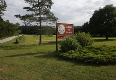
Trail Cycle of 101 km to be discovered at Bourgogne-Franche-Comté, Doubs, Saône. This trail is proposed by tracegps.

Description

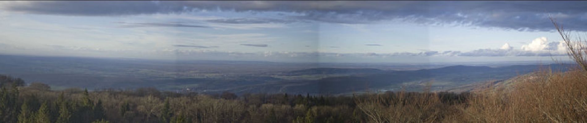
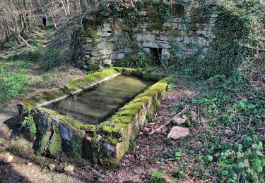
Jusqu'au pied du Mont Poupet circuit très roulant,l'ascension du Mont est assez raide surtout dans le dernier km. Avant de grimper le mont on peut aller voir la cascade du Gour de Conche, pour cela prendre à gauche à environ 2.3km avant le pied du Mont Poupet. Circuit balisé, à faire à pied (500 m)

Elevation profile

Photos

Positioning

Country:
France
Region :
Bourgogne-Franche-Comté
Department/Province :
Doubs
Municipality :
Saône
Location:
Unknown
Start:(UTM)
281905 ; 5234614 (32T) N.

Trails nearby

Trail Walking Montfaucon - Du chateau au fort de Monfaucon - Photo
Walking
yew

Walking

Easy
(1)
Montfaucon, Bourgogne-Franche-Comté, Doubs, France
6.9 km | 9.3 km-effort
1h 55min
Yes
Trail On foot Mamirolle - Sentier du Bois de la Fougère - Photo
On foot
PRO

On foot

Easy
Mamirolle, Bourgogne-Franche-Comté, Doubs, France
7.3 km | 8.7 km-effort
1h 58min
Yes
Trail On foot Nancray - Circuit du Chêne Président - Photo
On foot
PRO

On foot

Easy
Nancray, Bourgogne-Franche-Comté, Doubs, France
6.4 km | 7.2 km-effort
1h 38min
Yes
Trail On foot Montfaucon - Boucle de Nacra - Photo
On foot
PRO

On foot

Easy
Montfaucon, Bourgogne-Franche-Comté, Doubs, France
3 km | 4.4 km-effort
1h 0min
Yes
Trail On foot Saône - Sentier des Essarts - Photo
On foot
PRO

On foot

Easy
Saône, Bourgogne-Franche-Comté, Doubs, France
6.9 km | 8.1 km-effort
1h 50min
Yes
Trail On foot Montfaucon - Sentier des Falaises et du château - Photo
On foot
PRO

On foot

Easy
Montfaucon, Bourgogne-Franche-Comté, Doubs, France
5 km | 7.1 km-effort
1h 37min
Yes
Trail On foot Nancray - Sentier du Fonteny - Photo
On foot
PRO

On foot

Easy
Nancray, Bourgogne-Franche-Comté, Doubs, France
7.4 km | 9 km-effort
2h 2min
Yes
Trail On foot Montfaucon - Sentier du Fort et des Batteries - Photo
On foot
PRO

On foot

Easy
Montfaucon, Bourgogne-Franche-Comté, Doubs, France
6.6 km | 8.7 km-effort
1h 58min
Yes
Trail On foot Mamirolle - Sentier du Golf - Photo
On foot
PRO

On foot

Easy
Mamirolle, Bourgogne-Franche-Comté, Doubs, France
8.7 km | 10.4 km-effort
2h 21min
Yes


Close
My subscriptions