Trail Mountain bike Prades-d'Aubrac - Site VTT FFC Aubrac - Vallée du Lot - Circuit n°3 - La Maison Forestière des Rajals - Photo

Site VTT FFC Aubrac - Vallée du Lot - Circuit n°3 - La Maison Forestière des Rajals

 tracegps
tracegps

User

© OpenStreetMap contributors
Length
Length
13.2 km
Max alt
Max alt
1292 m
Uphill gradient
Uphill gradient
331 m
Km-Effort
Km-Effort  
17.6 km
Min alt
Min alt
1093 m
Downhill gradient
Downhill gradient
330 m
Boucle
Boucle
Yes
Creation date :
2014-12-10 00:00:00.0
Updated on :
2014-12-10 00:00:00.0

(0 Reviews)

Mountain bike
Mountain bike
1h15
Difficulty : Difficult

Scan this QR Code to open this trail in the SityTrail application

FREE GPS app for hiking

Logo SityTrail SityTrail

IGN / Geographical institutes

Download SityTrail from the App Store Download SityTrail from Google Play

Logo SityTrail SityTrail World

The world is yours!

Download SityTrail from the App Store Download SityTrail from Google Play Download SityTrail on Huawei AppGallery

About

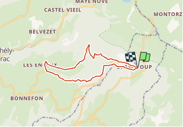
Trail Mountain bike of 13.2 km to be discovered at Occitania, Aveyron, Prades-d'Aubrac. This trail is proposed by tracegps.

Description

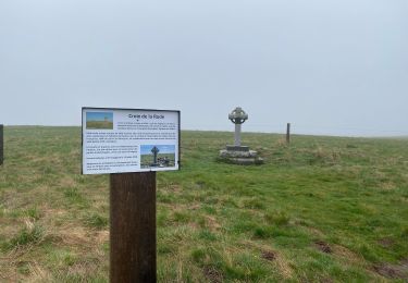
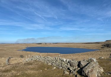
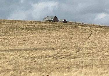
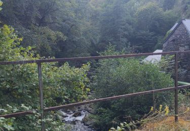
Site VTT FFC Aubrac – Vallée du Lot - Circuit n°3 - La Maison Forestière des Rajals. Circuit officiel labellisé par la Fédération Française de Cyclisme. Circuit très agréable en sous-bois, très roulant sur route et piste forestière, puis beau panoramique vers les Enfrux. Retour physique. Circuit fermé du 01 septembre au 31 mars (période de chasse). Renseignements : Office du Tourisme de St-Geniez-d'Olt - 4 Rue Cours - 12130 St-Geniez-d'Olt : 05 65 70 43 42.

Elevation profile

Photos

Positioning

Country:
France
Region :
Occitania
Department/Province :
Aveyron
Municipality :
Prades-d'Aubrac
Location:
Unknown
Start:(UTM)
501381 ; 4936690 (31T) N.

Trails nearby

Trail Walking Saint-Chély-d'Aubrac - Aubrac - St Côme d'Olt - Chemin de St-Jacques de Compostelle - Photo
Walking
tracegps

Walking

Very difficult
(1)
Saint-Chély-d'Aubrac, Occitania, Aveyron, France
23 km | 30 km-effort
5h 0min
No
Trail Walking Saint-Chély-d'Aubrac - Mon chemin de St Guilhem étape 3 - Photo
Walking
GUIDE
nadinebondoux

Walking

Medium
Saint-Chély-d'Aubrac, Occitania, Aveyron, France
24 km | 29 km-effort
5h 53min
No
Trail Walking Saint Geniez d'Olt et d'Aubrac - Croix de Rodes Lac de Bonnecombe Signal de Mailhebiau - Photo
Walking
GUIDE
antignacs

Walking

Easy
Saint Geniez d'Olt et d'Aubrac, Occitania, Aveyron, France
19.9 km | 26 km-effort
5h 55min
Yes
Trail Walking Saint-Chély-d'Aubrac - Étape 3 Saint Gilhem  - Photo
Walking
GUIDE
Roger Philippe Wallez

Walking

Very difficult
Saint-Chély-d'Aubrac, Occitania, Aveyron, France
23 km | 29 km-effort
6h 10min
No
Trail Walking Nasbinals - Tour des lacs - Photo
Walking
GUIDE
antignacs

Walking

Easy
Nasbinals, Occitania, Lozère, France
21 km | 25 km-effort
5h 8min
Yes
Trail Walking Nasbinals - Montorzier Croix de Vaysse Croix de Rodes - Photo
Walking
GUIDE
antignacs

Walking

Easy
Nasbinals, Occitania, Lozère, France
15.4 km | 19.6 km-effort
4h 13min
Yes
Trail Walking Saint-Chély-d'Aubrac - Compostelle / Chemin du Puy : de Aubrac à Bonneval - Photo
Walking
webmammuth

Walking

Difficult
Saint-Chély-d'Aubrac, Occitania, Aveyron, France
33 km | 46 km-effort
11h 0min
No
Trail Walking Nasbinals - Lac de Souveyrols Salles basses  - Photo
Walking
GUIDE
antignacs

Walking

Easy
Nasbinals, Occitania, Lozère, France
13.1 km | 16 km-effort
3h 39min
No
Trail Nordic walking Prades-d'Aubrac - SityTrail - Sentier thématique de Brameloup - Photo
Nordic walking
mdauzat

Nordic walking

Very easy
(1)
Prades-d'Aubrac, Occitania, Aveyron, France
7.8 km | 10.5 km-effort
2h 0min
Yes


Close
My subscriptions