Trail Mountain bike Oisseau-le-Petit - Oisseau-Le-Petit, Fyé, Saint-Victeur - Photo

Oisseau-Le-Petit, Fyé, Saint-Victeur

 tracegps
tracegps

User

© OpenStreetMap contributors
Length
Length
23 km
Max alt
Max alt
168 m
Uphill gradient
Uphill gradient
214 m
Km-Effort
Km-Effort  
26 km
Min alt
Min alt
76 m
Downhill gradient
Downhill gradient
213 m
Boucle
Boucle
Yes
Creation date :
2014-12-10 00:00:00.0
Updated on :
2014-12-10 00:00:00.0

(0 Reviews)

Mountain bike
Mountain bike
1h19
Difficulty : Easy

Scan this QR Code to open this trail in the SityTrail application

FREE GPS app for hiking

Logo SityTrail SityTrail

IGN / Geographical institutes

Download SityTrail from the App Store Download SityTrail from Google Play

Logo SityTrail SityTrail World

The world is yours!

Download SityTrail from the App Store Download SityTrail from Google Play Download SityTrail on Huawei AppGallery

About

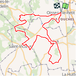
Trail Mountain bike of 23 km to be discovered at Pays de la Loire, Sarthe, Oisseau-le-Petit. This trail is proposed by tracegps.

Description

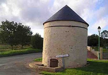
Voici une boucle facile, parfaite pour se détendre après une journée de travail ou pour l'hiver. De jolis passages plus particulièrement aux abords du château de Meslay et du château de Vaux. Un peu de chemin, surtout sur la fin.

Elevation profile

Positioning

Country:
France
Region :
Pays de la Loire
Department/Province :
Sarthe
Municipality :
Oisseau-le-Petit
Location:
Unknown
Start:(UTM)
284147 ; 5359157 (31U) N.

Trails nearby

Trail Walking Fyé - château de Meslay - Fresnay - Photo
Walking
mdeclemy

Walking

Easy
(1)
Fyé, Pays de la Loire, Sarthe, France
24 km | 28 km-effort
5h 59min
Yes
Trail Mountain bike Saint-Victeur - La Balade - Saint-Victeur  - Photo
Mountain bike
tracegps

Mountain bike

Easy
Saint-Victeur, Pays de la Loire, Sarthe, France
4.9 km | 5.8 km-effort
30min
Yes
Trail Walking Saint-Victeur - La Balade - Saint-Victeur  - Photo
Walking
tracegps

Walking

Easy
(1)
Saint-Victeur, Pays de la Loire, Sarthe, France
4.9 km | 5.8 km-effort
1h 15min
Yes
Trail Walking Béthon - bethon - Photo
Walking
leguitariste

Walking

Medium
Béthon, Pays de la Loire, Sarthe, France
9.2 km | 10.9 km-effort
2h 58min
Yes
Trail Walking Gesnes-le-Gandelin - Berus étang du mortier - Photo
Walking
HUBERTClaude

Walking

Difficult
Gesnes-le-Gandelin, Pays de la Loire, Sarthe, France
10.9 km | 12.2 km-effort
2h 34min
Yes
Trail Walking Bérus - Bérus - Photo
Walking
neitag61

Walking

Medium
Bérus, Pays de la Loire, Sarthe, France
12.7 km | 14.4 km-effort
3h 10min
Yes
Trail On foot Bourg-le-Roi - Par les portes et les remparts - Photo
On foot
roro1949

On foot

Very easy
Bourg-le-Roi, Pays de la Loire, Sarthe, France
8.4 km | 10.2 km-effort
2h 0min
Yes
Trail Walking Fyé - 2013-06-07_070602 - Photo
Walking
doudet

Walking

Very easy
Fyé, Pays de la Loire, Sarthe, France
24 km | 28 km-effort
Unknown
Yes
Trail Other activity Gesnes-le-Gandelin - gesnes  - Photo
Other activity
HUBERTClaude

Other activity

Very easy
Gesnes-le-Gandelin, Pays de la Loire, Sarthe, France
11 km | 12.6 km-effort
2h 46min
Yes


Close
My subscriptions