


Gréolières_Le_Cheiron__La_Clue

aljac
User

Length
11.8 km

Max alt
1764 m

Uphill gradient
897 m
Km-Effort
23 km

Min alt
884 m

Downhill gradient
672 m
Boucle
No
Creation date :
2019-01-15 17:01:01.12
Updated on :
2019-01-15 17:01:01.12
--
Difficulty : Unknown

FREE GPS app for hiking
 SityTrail
IGN / Geographical institutes
SityTrail Plus
The world is yours!
About
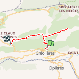
Trail Walking of 11.8 km to be discovered at Provence-Alpes-Côte d'Azur, Maritime Alps, Gréolières. This trail is proposed by aljac.
Positioning
Country:
France
Region :
Provence-Alpes-Côte d'Azur
Department/Province :
Maritime Alps
Municipality :
Gréolières
Location:
Unknown
Start:(Dec)
Start:(UTM)
334718 ; 4851437 (32T) N.
Comments