


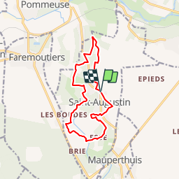

19 km | 23 km-effort


User


FREE GPS app for hiking
 SityTrail
IGN / Geographical institutes
SityTrail World
The world is yours!
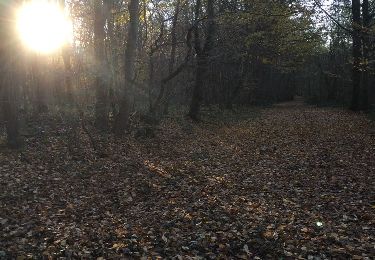
Trail Mountain bike of 12 km to be discovered at Ile-de-France, Seine-et-Marne, Saint-Augustin. This trail is proposed by tracegps.
Espace VTT FFC - Les Coteaux du Morin et de l'Aubetin - Circuit n° 15 - Saint Augustin La Communauté de Communes de la Brie des Templiers, en Seine-et-Marne, fait partie des collectivités qui ont participé à la réalisation de ce circuit. Départ : Mairie. De biens jolis passages… Sachez ouvrir vos yeux, et apprécier la beauté des paysages. Points d’accueils • Office du tourisme : 7 rue du Général de Gaulle - 77120 COULOMMIERS Tél. : 01 64 03 88 09 - mail : off.tourisme@coulommiers.fr • Vélo Nature : 8 avenue de Strasbourg - 77120 COULOMMIERS Tél. : 01 64 20 84 42 - mail : velonature@tele2.fr • Association cycliste partenaire Association Cycliste Pommeuse Boissy (ACPB) Site internet : http://acpommeuseboissy.free.fr

Other activity

Walking
Walking
On foot
Walking


sport
Walking

Walking

Walking
genial!!! Manque plus que le GPS vocal et c'est au top !!