


FORÊT DE BELVAL

PascalBanide
User
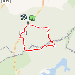

Length
5.2 km

Max alt
212 m

Uphill gradient
65 m
Km-Effort
6.1 km

Min alt
177 m

Downhill gradient
65 m
Boucle
Yes
Creation date :
2019-01-15 17:03:13.145
Updated on :
2019-01-15 17:03:13.145
2h07
Difficulty : Easy

FREE GPS app for hiking
 SityTrail
IGN / Geographical institutes
SityTrail Plus
The world is yours!
About
Trail Walking of 5.2 km to be discovered at Grand Est, Ardennes, Beaumont-en-Argonne. This trail is proposed by PascalBanide.
Positioning
Country:
France
Region :
Grand Est
Department/Province :
Ardennes
Municipality :
Beaumont-en-Argonne
Location:
Unknown
Start:(Dec)
Start:(UTM)
647419 ; 5486082 (31U) N.
Comments