Trail Walking Guidel -  Circuit du Loch - Guidel - Photo

Circuit du Loch - Guidel

 tracegps
tracegps

User

© OpenStreetMap contributors
Length
Length
12 km
Max alt
Max alt
37 m
Uphill gradient
Uphill gradient
148 m
Km-Effort
Km-Effort  
14 km
Min alt
Min alt
0 m
Downhill gradient
Downhill gradient
148 m
Boucle
Boucle
Yes
Creation date :
2014-12-10 00:00:00.0
Updated on :
2014-12-10 00:00:00.0

(1 Reviews)

Walking
Walking
2h45
Difficulty : Medium

Scan this QR Code to open this trail in the SityTrail application

FREE GPS app for hiking

Logo SityTrail SityTrail

IGN / Geographical institutes

Download SityTrail from the App Store Download SityTrail from Google Play

Logo SityTrail SityTrail World

The world is yours!

Download SityTrail from the App Store Download SityTrail from Google Play Download SityTrail on Huawei AppGallery

About

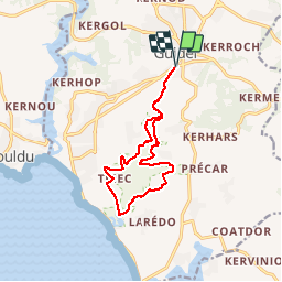
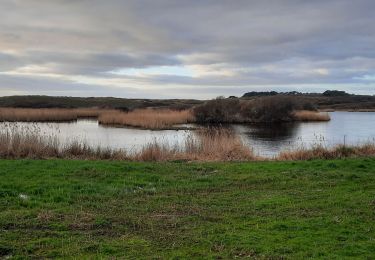
Trail Walking of 12 km to be discovered at Brittany, Morbihan, Guidel. This trail is proposed by tracegps.

Description

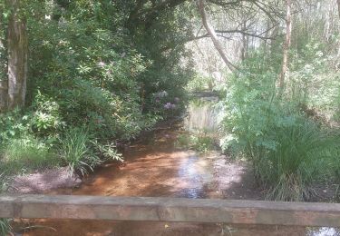
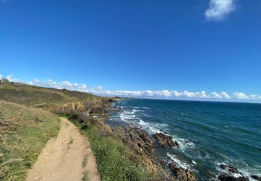
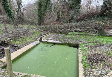
Circuit de 12 kilomètres se fait facilement en 2h45. Vous partez de la grande surface super U et prenez en face entre la cité des HLM et traversez le parc, en bas du parc prenez à gauche et longez entre le ruisseau et la station d'épuration. Le long de votre circuit vous trouverez des observatoires d'oiseaux et traverserez des zones humides (praticables) de roseaux.

Elevation profile

Photos

Positioning

Country:
France
Region :
Brittany
Department/Province :
Morbihan
Municipality :
Guidel
Location:
Unknown
Start:(UTM)
463192 ; 5292678 (30T) N.

Comments

Please log in to post a review or rate the element


Trails nearby

Trail Walking Guidel - PR_56_Guidel_DA_04_De-Guidel-Centre-Vers-La-Laita_20240510 - Photo
Walking
patrickdanilo

Walking

Difficult
Guidel, Brittany, Morbihan, France
14.7 km | 17.9 km-effort
4h 3min
Yes
Trail Walking Clohars-Carnoët - Le Pouldu - Photo
Walking
FOUCAULT

Walking

Clohars-Carnoët, Brittany, Finistère, France
8.1 km | 8.9 km-effort
2h 35min
Yes
Trail Walking Guidel - Guidel plage 7,6 km - Photo
Walking
GUIDE
rvapeldo

Walking

Easy
Guidel, Brittany, Morbihan, France
7.6 km | 8.5 km-effort
2h 11min
Yes
Trail Walking Clohars-Carnoët - Pouldu port peintres 6,3 km - Photo
Walking
GUIDE
rvapeldo

Walking

Easy
Clohars-Carnoët, Brittany, Finistère, France
6.3 km | 7.2 km-effort
2h 12min
Yes
Trail Walking Clohars-Carnoët - Pouldu Roche Percée et retour 9,5 km - Photo
Walking
GUIDE
rvapeldo

Walking

Medium
Clohars-Carnoët, Brittany, Finistère, France
9.5 km | 10.7 km-effort
2h 46min
Yes
Trail Walking Guidel - PR_56_Guidel_BA_02_Circuit3b_Entre-Loch-Et-Laita_20231004 - Photo
Walking
patrickdanilo

Walking

Easy
Guidel, Brittany, Morbihan, France
13.4 km | 15.7 km-effort
3h 34min
Yes
Trail Walking Guidel - laita - Photo
Walking
dcharbonnier

Walking

Medium
Guidel, Brittany, Morbihan, France
9.8 km | 12 km-effort
3h 58min
Yes
Trail Electric bike Clohars-Carnoët - Moelans Pontivy par les berges du Blavet - Photo
Electric bike
ilefebvre

Electric bike

Very easy
Clohars-Carnoët, Brittany, Finistère, France
81 km | 94 km-effort
4h 43min
No
Trail Walking Guidel - PR_56_Guidel_AA_01_Circuit3b_Autour-Du-Loc'h_20220120 - Photo
Walking
patrickdanilo

Walking

Medium
Guidel, Brittany, Morbihan, France
9.8 km | 11.2 km-effort
2h 16min
Yes


Close
My subscriptions