Trail Mountain bike Cambounès - Espace VTT FFC - VTT en Pays Brassagais - Circuit n° 08 - Chemin de Combelirou et Fontbelle - Cambounes - Photo

Espace VTT FFC - VTT en Pays Brassagais - Circuit n° 08 - Chemin de Combelirou et Fontbelle - Cambounes

 tracegps
tracegps

User

© OpenStreetMap contributors
Length
Length
15.1 km
Max alt
Max alt
667 m
Uphill gradient
Uphill gradient
488 m
Km-Effort
Km-Effort  
22 km
Min alt
Min alt
395 m
Downhill gradient
Downhill gradient
486 m
Boucle
Boucle
Yes
Creation date :
2014-12-10 00:00:00.0
Updated on :
2014-12-10 00:00:00.0

(0 Reviews)

Mountain bike
Mountain bike
1h30
Difficulty : Medium

Scan this QR Code to open this trail in the SityTrail application

FREE GPS app for hiking

Logo SityTrail SityTrail

IGN / Geographical institutes

Download SityTrail from the App Store Download SityTrail from Google Play

Logo SityTrail SityTrail World

The world is yours!

Download SityTrail from the App Store Download SityTrail from Google Play Download SityTrail on Huawei AppGallery

About

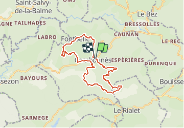
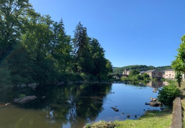
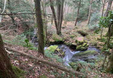
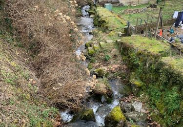
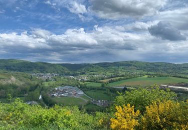
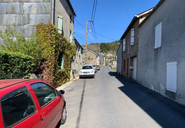
Trail Mountain bike of 15.1 km to be discovered at Occitania, Tarn, Cambounès. This trail is proposed by tracegps.

Description

Espace VTT FFC : VTT en Pays Brassagais - Circuit n° 08 - Chemin de Combelirou et Fontbelle. Circuit officiel labellisé par la Fédération Française de Cyclisme. Au départ de Cambounès, le circuit se déroule des deux côtés de la vallée de la Durenque et peut être réalisé en 2 fois. Paysages grandioses. Belles descentes. Église et statue menhir à Fontbelle

Elevation profile

Photos

Positioning

Country:
France
Region :
Occitania
Department/Province :
Tarn
Municipality :
Cambounès
Location:
Unknown
Start:(UTM)
454922 ; 4826070 (31T) N.

Trails nearby

Trail Walking Boissezon - 81_Boissezon - Photo
Walking
jab31

Walking

Difficult
(1)
Boissezon, Occitania, Tarn, France
18.5 km | 26 km-effort
4h 21min
Yes
Trail Walking Boissezon - Boissezon - Castres - Photo
Walking
RR31

Walking

Medium
Boissezon, Occitania, Tarn, France
19.7 km | 25 km-effort
Unknown
No
Trail Walking Brassac - Henry IV - Photo
Walking
cedric.fargues

Walking

Medium
Brassac, Occitania, Tarn, France
9.2 km | 12.8 km-effort
2h 56min
Yes
Trail Walking Brassac - Grand tour du Salas  - Photo
Walking
cedric.fargues

Walking

Medium
Brassac, Occitania, Tarn, France
12.4 km | 17.6 km-effort
4h 6min
Yes
Trail Walking Brassac - Ruisseau du Ser  - Photo
Walking
cedric.fargues

Walking

Medium
Brassac, Occitania, Tarn, France
4.8 km | 8.5 km-effort
1h 58min
Yes
Trail Walking Brassac - L’escalier de la Peyre par les Costes - Photo
Walking
cedric.fargues

Walking

Difficult
Brassac, Occitania, Tarn, France
10.3 km | 14.8 km-effort
2h 47min
Yes
Trail Walking Brassac - Croix de Barbariol - Photo
Walking
cedric.fargues

Walking

Medium
Brassac, Occitania, Tarn, France
9.5 km | 12.6 km-effort
3h 0min
No
Trail Walking Brassac - Les costes par le Salas - Photo
Walking
cedric.fargues

Walking

Medium
Brassac, Occitania, Tarn, France
5.9 km | 7.9 km-effort
1h 30min
Yes
Trail Walking Brassac - 2014 06 08_16h51m47_au tour de brassac - Photo
Walking
cedric.fargues

Walking

Medium
(1)
Brassac, Occitania, Tarn, France
17.5 km | 25 km-effort
5h 2min
No


Close
My subscriptions