Trail Mountain bike Viscomtat - Bois Noirs Oxygène 2010 - 9eme edition - 43 kms - Photo

Bois Noirs Oxygène 2010 - 9eme edition - 43 kms

 tracegps
tracegps

User

© OpenStreetMap contributors
Length
Length
42 km
Max alt
Max alt
1191 m
Uphill gradient
Uphill gradient
1434 m
Km-Effort
Km-Effort  
61 km
Min alt
Min alt
611 m
Downhill gradient
Downhill gradient
1435 m
Boucle
Boucle
Yes
Creation date :
2014-12-10 00:00:00.0
Updated on :
2014-12-10 00:00:00.0

(0 Reviews)

Mountain bike
Mountain bike
4h40
Difficulty : Difficult

Scan this QR Code to open this trail in the SityTrail application

FREE GPS app for hiking

Logo SityTrail SityTrail

IGN / Geographical institutes

Download SityTrail from the App Store Download SityTrail from Google Play

Logo SityTrail SityTrail World

The world is yours!

Download SityTrail from the App Store Download SityTrail from Google Play Download SityTrail on Huawei AppGallery

About

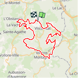
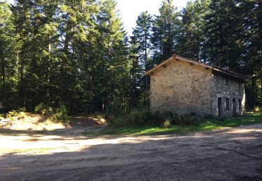
Trail Mountain bike of 42 km to be discovered at Auvergne-Rhône-Alpes, Puy-de-Dôme, Viscomtat. This trail is proposed by tracegps.

Description

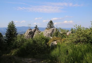
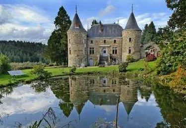
Très beau parcours pour cette 9eme édition de la Bois Noirs Oxygène. Départ du lieu dit "la planche". Assez roulant tout en étant technique et physique. Attention les chemins sont boueux fin juin. Magnifique panorama au bois de Pamole.

Elevation profile

Positioning

Country:
France
Region :
Auvergne-Rhône-Alpes
Department/Province :
Puy-de-Dôme
Municipality :
Viscomtat
Location:
Unknown
Start:(UTM)
551709 ; 5076200 (31T) N.

Trails nearby

Trail On foot Celles-sur-Durolle - Le Puy d'Oscot - Photo
On foot
GUIDE+

On foot

Medium
Celles-sur-Durolle, Auvergne-Rhône-Alpes, Puy-de-Dôme, France
15.2 km | 22 km-effort
4h 59min
Yes
Trail On foot Vollore-Montagne - Pierre Pamole - Photo
On foot
GUIDE+

On foot

Medium
Vollore-Montagne, Auvergne-Rhône-Alpes, Puy-de-Dôme, France
15.5 km | 22 km-effort
4h 57min
Yes
Trail On foot Vollore-Ville - Le Grun de Chignore - Photo
On foot
GUIDE+

On foot

Medium
Vollore-Ville, Auvergne-Rhône-Alpes, Puy-de-Dôme, France
15.1 km | 24 km-effort
5h 27min
No
Trail Walking Viscomtat - La Virée des Rocs Nº2/Rocher de Pierre Beille - Photo
Walking
boulinevelyne

Walking

Difficult
Viscomtat, Auvergne-Rhône-Alpes, Puy-de-Dôme, France
16.1 km | 23 km-effort
4h 45min
Yes
Trail Walking Sainte-Agathe - Ste_Agathe_Peage - Photo
Walking
GUIDE
jagarnier

Walking

Medium
Sainte-Agathe, Auvergne-Rhône-Alpes, Puy-de-Dôme, France
11.1 km | 16.4 km-effort
3h 15min
Yes
Trail Walking Chabreloche - Tracé actuel: 18 AVR 2019 08:39 - Photo
Walking
GilGry

Walking

Medium
Chabreloche, Auvergne-Rhône-Alpes, Puy-de-Dôme, France
22 km | 35 km-effort
7h 0min
Yes
Trail Walking Sainte-Agathe - Saint agate 3ieme jour - Photo
Walking
jpdroux

Walking

Difficult
Sainte-Agathe, Auvergne-Rhône-Alpes, Puy-de-Dôme, France
11.6 km | 16.1 km-effort
4h 45min
Yes
Trail On foot Chabreloche - Le Roc du Guet - Photo
On foot
GUIDE+

On foot

Easy
Chabreloche, Auvergne-Rhône-Alpes, Puy-de-Dôme, France
10.5 km | 15.3 km-effort
3h 29min
No
Trail On foot Sainte-Agathe - Le Peage - Photo
On foot
GUIDE+

On foot

Easy
Sainte-Agathe, Auvergne-Rhône-Alpes, Puy-de-Dôme, France
10.1 km | 14.8 km-effort
3h 22min
Yes


Close
My subscriptions