


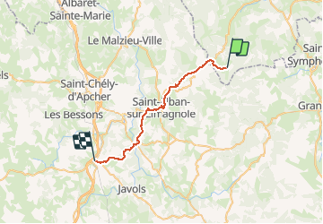
Etape04- Le-Sauvage-Aumont-Aubrac

ghislainem
User

Length
28 km

Max alt
1336 m

Uphill gradient
550 m
Km-Effort
36 km

Min alt
918 m

Downhill gradient
790 m
Boucle
No
Creation date :
2019-01-15 17:36:28.606
Updated on :
2020-08-09 07:09:37.699
7h38
Difficulty : Unknown

FREE GPS app for hiking
 SityTrail
IGN / Geographical institutes
SityTrail Plus
The world is yours!
About
Trail Walking of 28 km to be discovered at Auvergne-Rhône-Alpes, Haute-Loire, Chanaleilles. This trail is proposed by ghislainem.
Positioning
Country:
France
Region :
Auvergne-Rhône-Alpes
Department/Province :
Haute-Loire
Municipality :
Chanaleilles
Location:
Unknown
Start:(Dec)
Start:(UTM)
538551 ; 4963555 (31T) N.
Comments