Trail Cycle Lalbenque - Circuit cyclotourisme Lalbenque / St Cirq Lapopie - Photo

Circuit cyclotourisme Lalbenque / St Cirq Lapopie

 tracegps
tracegps

User

© OpenStreetMap contributors
Length
Length
61 km
Max alt
Max alt
374 m
Uphill gradient
Uphill gradient
1025 m
Km-Effort
Km-Effort  
75 km
Min alt
Min alt
120 m
Downhill gradient
Downhill gradient
1024 m
Boucle
Boucle
Yes
Creation date :
2014-12-10 00:00:00.0
Updated on :
2014-12-10 00:00:00.0

(1 Reviews)

Cycle
Cycle
6h00
Difficulty : Difficult

Scan this QR Code to open this trail in the SityTrail application

FREE GPS app for hiking

Logo SityTrail SityTrail

IGN / Geographical institutes

Download SityTrail from the App Store Download SityTrail from Google Play

Logo SityTrail SityTrail World

The world is yours!

Download SityTrail from the App Store Download SityTrail from Google Play Download SityTrail on Huawei AppGallery

About

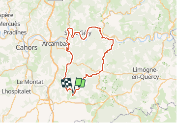
Trail Cycle of 61 km to be discovered at Occitania, Lot, Lalbenque. This trail is proposed by tracegps.

Description

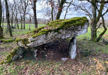
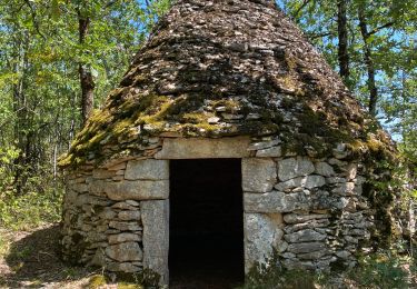
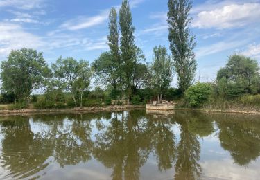
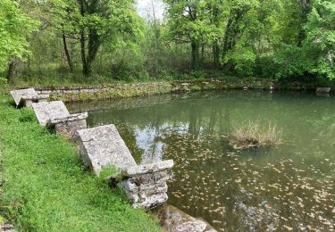
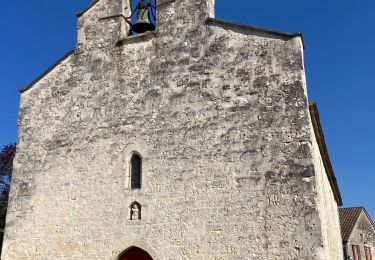
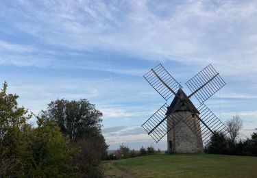
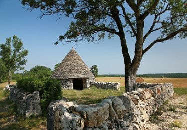
Un itinéraire parfait pour visiter en douceur la richesse du terroir Quercynois et du Parc Naturel Régional des Causses du Quercy. De vallée en causses et de causses en vallée, vous découvrirez la magie de ces paysages aussi différents les uns que les autres et de cet habitat qui se renouvelle sans cesse.

Elevation profile

Photos

Points of interest

Point of interest Lalbenque - Gîte de Poudally - Photo
tracegps
Point of interest Laburgade - Chemin des puits - Photo
tracegps
LABURGADE 
Point of interest Aujols - Lavoir papillon Aujols - Photo
tracegps
Point of interest Bouziès - Porte des Anglais - Photo
tracegps
Point of interest Saint-Cirq-Lapopie - Village St Cirq Lapopie - Photo
tracegps
SAINT-CIRQ-LAPOPIE 
Point of interest Saint-Cirq-Lapopie - Cirque de Venes - Photo
tracegps
SAINT-CIRQ-LAPOPIE 

Positioning

Country:
France
Region :
Occitania
Department/Province :
Lot
Municipality :
Lalbenque
Location:
Unknown
Start:(UTM)
385879 ; 4912464 (31T) N.

Comments

Please log in to post a review or rate the element


Trails nearby

Trail Walking Escamps - de Varaire à Lalbenque Lot  - Photo
Walking
Maria Chapalain

Walking

Medium
Escamps, Occitania, Lot, France
7.2 km | 8.3 km-effort
4h 44min
No
Trail Walking Lalbenque - Balade coup de coeur du gîte de Poudally - Photo
Walking
tracegps

Walking

Medium
Lalbenque, Occitania, Lot, France
16.4 km | 19.9 km-effort
4h 30min
Yes
Trail Walking Lalbenque - Lalbenque pr courbesse - Photo
Walking
Glurps

Walking

Difficult
Lalbenque, Occitania, Lot, France
10.3 km | 12.4 km-effort
2h 49min
Yes
Trail sport Lalbenque - Lalbenque cieurac pauliac - Photo
sport
Glurps

sport

Very easy
Lalbenque, Occitania, Lot, France
14.5 km | 17.3 km-effort
Unknown
Yes
Trail Walking Laburgade - Laburgade Cremps  - Photo
Walking
GUIDE
antignacs

Walking

Very easy
Laburgade, Occitania, Lot, France
15.1 km | 18 km-effort
3h 12min
Yes
Trail Walking Cremps - Cremps 3 - Photo
Walking
GUIDE
antignacs

Walking

Very easy
Cremps, Occitania, Lot, France
4.5 km | 5.8 km-effort
1h 7min
Yes
Trail Walking Laburgade - Laburgade GR65 - Photo
Walking
GUIDE
antignacs

Walking

Very easy
Laburgade, Occitania, Lot, France
9.5 km | 10.9 km-effort
1h 59min
Yes
Trail Walking Cieurac - Cieurac Pauliac  - Photo
Walking
GUIDE
antignacs

Walking

Very easy
Cieurac, Occitania, Lot, France
12 km | 14.3 km-effort
2h 29min
Yes
Trail Mountain bike Lalbenque - AU PAYS DU DIAMANT NOIR - DECOUVERTE DU PAYS DES TRUFFES - Photo
Mountain bike
Gpoujade

Mountain bike

Very difficult
Lalbenque, Occitania, Lot, France
58 km | 68 km-effort
3h 38min
Yes


Close
My subscriptions