Trail Mountain bike Orbec - Randonnée VTT de l'Orbiquet 2010 31 Kms - Photo

Randonnée VTT de l'Orbiquet 2010 31 Kms

 tracegps
tracegps

User

© OpenStreetMap contributors
Length
Length
29 km
Max alt
Max alt
195 m
Uphill gradient
Uphill gradient
426 m
Km-Effort
Km-Effort  
35 km
Min alt
Min alt
94 m
Downhill gradient
Downhill gradient
427 m
Boucle
Boucle
Yes
Creation date :
2014-12-10 00:00:00.0
Updated on :
2014-12-10 00:00:00.0

(0 Reviews)

Mountain bike
Mountain bike
2h30
Difficulty : Medium

Scan this QR Code to open this trail in the SityTrail application

FREE GPS app for hiking

Logo SityTrail SityTrail

IGN / Geographical institutes

Download SityTrail from the App Store Download SityTrail from Google Play

Logo SityTrail SityTrail World

The world is yours!

Download SityTrail from the App Store Download SityTrail from Google Play Download SityTrail on Huawei AppGallery

About

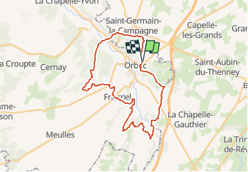
Trail Mountain bike of 29 km to be discovered at Normandy, Calvados, Orbec. This trail is proposed by tracegps.

Description

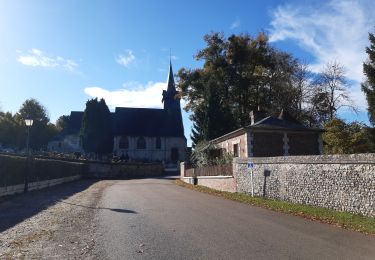
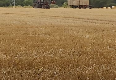
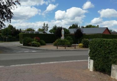
Départ Salle des Fêtes de LA VESPIERE, c'est le circuit de la rando raid de L'Orbiquet 2010 celui de 31 km avec une dénivelé positif de près de 450 m. Passage dans les bois près de ST GERMAIN LA CAMPAGNE pour redescendre dan la vallée de L'Orbiquet et traversée de la rivière. Ensuite remontée dans le bois de Val Himbert, se diriger vers la Folletière Abenon (chemins et bois), ensuite traversée d'une Cressonière pour un beau bout de parcours dans les bois au dessus de la Folletière Abenon. puis redescente sur la Folletière puis nouvelle longue montée vers Saint Jean du Theney. Ensuite enfilade entre les champs pour une descente en foret pour rejoindre le château de La Vespiere pour terminer par une super montée de la cote blanche au dessus de la champignonnière et retour salle des fêtes de LA VESPIERE

Elevation profile

Positioning

Country:
France
Region :
Normandy
Department/Province :
Calvados
Municipality :
Orbec
Location:
Unknown
Start:(UTM)
311020 ; 5433342 (31U) N.

Trails nearby

Trail Cycle Saint-Germain-la-Campagne - Boucle des maisons de maîtres  -  St-Germain la Campagne - Photo
Cycle
tracegps

Cycle

Medium
(1)
Saint-Germain-la-Campagne, Normandy, Eure, France
16.3 km | 17.4 km-effort
1h 0min
Yes
Trail Walking Saint-Martin-de-Bienfaite-la-Cressonnière - saint Martin de bienfaite la cressonnière - Photo
Walking
werth

Walking

Medium
Saint-Martin-de-Bienfaite-la-Cressonnière, Normandy, Calvados, France
9.6 km | 12.2 km-effort
2h 52min
Yes
Trail Walking Livarot-Pays-d'Auge - Cerqueux  - Photo
Walking
Eve - Line

Walking

Easy
Livarot-Pays-d'Auge, Normandy, Calvados, France
8.2 km | 9.1 km-effort
2h 8min
Yes
Trail Walking Saint-Germain-la-Campagne - Chemin du Sabot bis - Photo
Walking
FROIDMONT

Walking

Easy
(1)
Saint-Germain-la-Campagne, Normandy, Eure, France
9.8 km | 11.2 km-effort
2h 34min
Yes
Trail Walking La Chapelle-Gauthier - La Mare Péreuse - La Chapelle-Gauthier - Photo
Walking
tracegps

Walking

Medium
La Chapelle-Gauthier, Normandy, Eure, France
10.3 km | 11.9 km-effort
2h 45min
Yes
Trail Walking Livarot-Pays-d'Auge - Cerqueux (14) - Photo
Walking
Eve - Line

Walking

Medium
Livarot-Pays-d'Auge, Normandy, Calvados, France
15.8 km | 18.1 km-effort
3h 43min
Yes
Trail Walking Saint-Germain-la-Campagne - st Germain le campagne  - Photo
Walking
ymarvin

Walking

Easy
Saint-Germain-la-Campagne, Normandy, Eure, France
8.3 km | 9.3 km-effort
1h 40min
Yes
Trail Walking La Vespière-Friardel - La Vespiere  - Photo
Walking
Eve - Line

Walking

Medium
La Vespière-Friardel, Normandy, Calvados, France
22 km | 27 km-effort
4h 22min
Yes
Trail Walking Saint-Germain-la-Campagne - Chemin du Sabot - St Germain la Campagne - Photo
Walking
tracegps

Walking

Medium
Saint-Germain-la-Campagne, Normandy, Eure, France
8.6 km | 9.2 km-effort
2h 10min
Yes


Close
My subscriptions