Trail Walking Fanlo - Mont Perdu et Crête de Gavarnie - Photo

Mont Perdu et Crête de Gavarnie

 tracegps
tracegps

User

© OpenStreetMap contributors
Length
Length
15.7 km
Max alt
Max alt
3322 m
Uphill gradient
Uphill gradient
1720 m
Km-Effort
Km-Effort  
38 km
Min alt
Min alt
2223 m
Downhill gradient
Downhill gradient
1585 m
Boucle
Boucle
No
Creation date :
2014-12-10 00:00:00.0
Updated on :
2014-12-10 00:00:00.0

(0 Reviews)

Walking
Walking
12h00
Difficulty : Difficult

Scan this QR Code to open this trail in the SityTrail application

FREE GPS app for hiking

Logo SityTrail SityTrail

IGN / Geographical institutes

Download SityTrail from the App Store Download SityTrail from Google Play

Logo SityTrail SityTrail World

The world is yours!

Download SityTrail from the App Store Download SityTrail from Google Play Download SityTrail on Huawei AppGallery

About

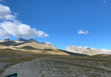
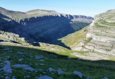
Trail Walking of 15.7 km to be discovered at Aragon, Huesca, Fanlo. This trail is proposed by tracegps.

Description

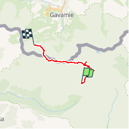
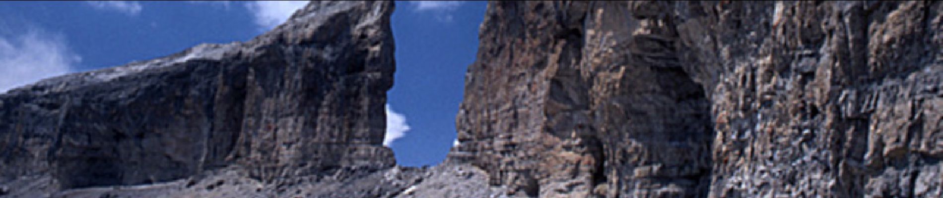
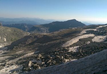
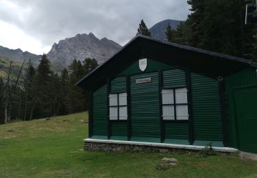
Au départ du refuge de Goriz, l'ascension du Mont Perdu, puis retour vers le Col des tentes (au-dessus de Gavarnie) via le Cylindre, puis la Tour, la Brèche de Roland, le refuge de Sarradets.

Elevation profile

Photos

Positioning

Country:
Spain
Region :
Aragon
Department/Province :
Huesca
Municipality :
Fanlo
Location:
Unknown
Start:(UTM)
255507 ; 4727696 (31T) N.

Trails nearby

Trail Walking Gavarnie-Gèdre - Mont Perdu - Photo
Walking
pffrench

Walking

Difficult
Gavarnie-Gèdre, Occitania, Hautespyrenees, France
20 km | 38 km-effort
13h 21min
No
Trail Walking Gavarnie-Gèdre - refuge de la brèche refuge des espuguettes - Photo
Walking
arremoulit

Walking

Very difficult
Gavarnie-Gèdre, Occitania, Hautespyrenees, France
12.7 km | 23 km-effort
7h 29min
No
Trail Horseback riding Fanlo - Parc National d’Ordesa J3 pm - Photo
Horseback riding
alfreson

Horseback riding

Fanlo, Aragon, Huesca, Spain
14.4 km | 19.6 km-effort
3h 38min
No
Trail Walking Bielsa - 2016 -07-29 Pineta-Gavarnie  - Photo
Walking
meunier.ph.

Walking

Difficult
Bielsa, Aragon, Huesca, Spain
14.5 km | 31 km-effort
6h 1min
No
Trail Walking Fanlo - 2016 -07-28 Goriz -Pineta - Photo
Walking
meunier.ph.

Walking

Very difficult
Fanlo, Aragon, Huesca, Spain
19.4 km | 37 km-effort
8h 30min
No
Trail Walking Fanlo - J4 - Rando FCCAM 2024 - Photo
Walking
neptunos

Walking

Very difficult
Fanlo, Aragon, Huesca, Spain
18.8 km | 35 km-effort
7h 53min
No
Trail Walking Fanlo - J3 - Rando FFCAM 2024 - Photo
Walking
neptunos

Walking

Very difficult
Fanlo, Aragon, Huesca, Spain
7.9 km | 23 km-effort
5h 11min
Yes
Trail Walking Gavarnie-Gèdre - J2 - Rando FFCAM 2024 - Photo
Walking
neptunos

Walking

Difficult
Gavarnie-Gèdre, Occitania, Hautespyrenees, France
7.2 km | 13.4 km-effort
3h 3min
No
Trail Walking Gavarnie-Gèdre - talion - Photo
Walking
Alain Aerts

Walking

Medium
Gavarnie-Gèdre, Occitania, Hautespyrenees, France
3.2 km | 8.2 km-effort
1h 51min
Yes


Close
My subscriptions