Trail Mountain bike Bornel - Le Chemin d'Angleterre - Bornel - Photo

Le Chemin d'Angleterre - Bornel

 tracegps
tracegps

User

© OpenStreetMap contributors
Length
Length
43 km
Max alt
Max alt
178 m
Uphill gradient
Uphill gradient
474 m
Km-Effort
Km-Effort  
49 km
Min alt
Min alt
44 m
Downhill gradient
Downhill gradient
475 m
Boucle
Boucle
Yes
Creation date :
2014-12-10 00:00:00.0
Updated on :
2014-12-10 00:00:00.0

(1 Reviews)

Mountain bike
Mountain bike
3h00
Difficulty : Medium

Scan this QR Code to open this trail in the SityTrail application

FREE GPS app for hiking

Logo SityTrail SityTrail

IGN / Geographical institutes

Download SityTrail from the App Store Download SityTrail from Google Play

Logo SityTrail SityTrail World

The world is yours!

Download SityTrail from the App Store Download SityTrail from Google Play Download SityTrail on Huawei AppGallery

About

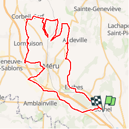
Trail Mountain bike of 43 km to be discovered at Hauts-de-France, Oise, Bornel. This trail is proposed by tracegps.

Description

Circuit découverte de la Communauté de Communes des Sablons.
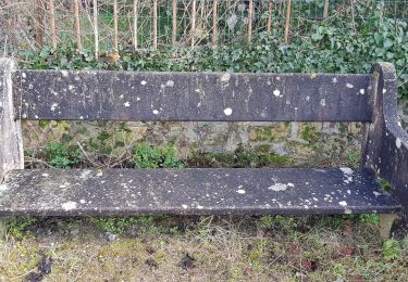
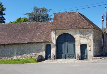
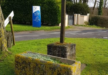
Elevation profile

Photos

Positioning

Country:
France
Region :
Hauts-de-France
Department/Province :
Oise
Municipality :
Bornel
Location:
Bornel
Start:(UTM)
442306 ; 5449466 (31U) N.

Comments

Please log in to post a review or rate the element


Trails nearby

Trail Walking Ronquerolles - Ronquerolles Chambly Removal - Photo
Walking
avdem

Walking

Very easy
Ronquerolles, Ile-de-France, Val-d'Oise, France
11.5 km | 14.2 km-effort
3h 1min
Yes
Trail Walking Ronquerolles - Tour de Chambly départ Ronquerolles - Photo
Walking
avdem

Walking

Easy
Ronquerolles, Ile-de-France, Val-d'Oise, France
12 km | 14.6 km-effort
2h 50min
Yes
Trail Walking Chambly - Chambly - Photo
Walking
avdem

Walking

Easy
Chambly, Hauts-de-France, Oise, France
17 km | 19.3 km-effort
2h 29min
No
Trail Walking Hédouville - Tour d'Hedouville - Photo
Walking
avdem

Walking

Medium
Hédouville, Ile-de-France, Val-d'Oise, France
12 km | 14.5 km-effort
2h 41min
Yes
Trail Walking Ronquerolles - Ronquerolle Messelan Houdan - Photo
Walking
avdem

Walking

Difficult
Ronquerolles, Ile-de-France, Val-d'Oise, France
12.7 km | 16.3 km-effort
2h 57min
Yes
Trail Walking Ronquerolles - ronquerolles - Photo
Walking
louis-guy Michineau

Walking

Medium
(1)
Ronquerolles, Ile-de-France, Val-d'Oise, France
6.3 km | 7.4 km-effort
1h 34min
Yes
Trail Walking Chambly - Chambly Gabdicourt, Ronquerole - Photo
Walking
avdem

Walking

Medium
Chambly, Hauts-de-France, Oise, France
8.9 km | 10.1 km-effort
2h 5min
No
Trail Walking Bornel - Fosseuse Anservkille - Photo
Walking
avdem

Walking

Very easy
Bornel, Hauts-de-France, Oise, France
11.4 km | 13.3 km-effort
2h 38min
No
Trail Walking Ronquerolles - Ronquerolles - Photo
Walking
avdem

Walking

Very easy
Ronquerolles, Ile-de-France, Val-d'Oise, France
10.9 km | 14 km-effort
3h 9min
Yes


Close
My subscriptions