


Quadrillage 1

vindju
User
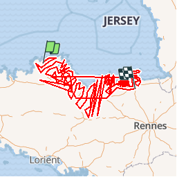

Length
1374 km

Max alt
322 m

Uphill gradient
16681 m
Km-Effort
1597 km

Min alt
-3 m

Downhill gradient
16731 m
Boucle
No
Creation date :
2019-05-07 13:27:58.577
Updated on :
2019-05-07 13:27:59.557
350h18
Difficulty : Easy

FREE GPS app for hiking
 SityTrail
IGN / Geographical institutes
SityTrail Plus
The world is yours!
About
Trail Walking of 1374 km to be discovered at Brittany, Côtes-d'Armor, Kermaria-Sulard. This trail is proposed by vindju.
Description
Quadrillage
Positioning
Country:
France
Region :
Brittany
Department/Province :
Côtes-d'Armor
Municipality :
Kermaria-Sulard
Location:
Unknown
Start:(Dec)
Start:(UTM)
471287 ; 5402460 (30U) N.
Comments