


Lelex Grand Crêt

reneperrin
User
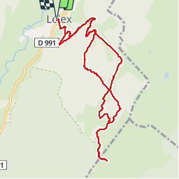

Length
11.5 km

Max alt
1683 m

Uphill gradient
791 m
Km-Effort
22 km

Min alt
889 m

Downhill gradient
791 m
Boucle
Yes
Creation date :
2019-01-15 18:10:46.567
Updated on :
2019-01-15 18:10:46.567
4h42
Difficulty : Medium

FREE GPS app for hiking
 SityTrail
IGN / Geographical institutes
SityTrail Plus
The world is yours!
About
Trail Walking of 11.5 km to be discovered at Auvergne-Rhône-Alpes, Ain, Lélex. This trail is proposed by reneperrin.
Description
boucle, premières neiges d'automne
Photos


Positioning
Country:
France
Region :
Auvergne-Rhône-Alpes
Department/Province :
Ain
Municipality :
Lélex
Location:
Unknown
Start:(Dec)
Start:(UTM)
726440 ; 5131876 (31T) N.
Comments