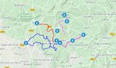
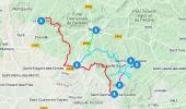
Trail Walking Igé - Traversées Percheronnes Igé - Sainte-Gauburge Via Appenai-sous-Bellême 20,5 Km - Photo

Traversées Percheronnes Igé - Sainte-Gauburge Via Appenai-sous-Bellême 20,5 Km

Un maillage d'une centaine de parcours pour composer à la carte sa randonnée itinérante percheronne.

© OpenStreetMap contributors
Length
Length
20 km
Max alt
Max alt
217 m
Uphill gradient
Uphill gradient
311 m
Km-Effort
Km-Effort  
24 km
Min alt
Min alt
112 m
Downhill gradient
Downhill gradient
282 m
Boucle
Boucle
No
Creation date :
2019-04-13 16:33:16.494
Updated on :
2020-12-19 08:20:56.483

(0 Reviews)

Walking
Walking
5h18
Difficulty : Medium

Scan this QR Code to open this trail in the SityTrail application

FREE GPS app for hiking

Logo SityTrail SityTrail

IGN / Geographical institutes

Download SityTrail from the App Store Download SityTrail from Google Play

Logo SityTrail SityTrail World
The world is yours!

Download SityTrail from the App Store Download SityTrail from Google Play Download SityTrail on Huawei AppGallery

About

Trail Walking of 20 km to be discovered at Normandy, Orne, Igé. This trail is proposed by Traversées Percheronnes.

Description

"Traversées Percheronnes" vous propose près de 105 randonnées linéaires organisées en mailles sur le territoire du grand Perche. ?Pour chaque ville ou village étape, nous vous proposons des destinations pouvant être atteintes à pied ou à VTT.?Vous pouvez ainsi composer votre randonnée itinérante à la carte selon le nombre de jours dont vous disposez.... Et des capacités d'hébergement (possibilité de négocier un "taxi" auprès de certaines chambres d’hôtes).?Les topos guides détaillés sont disponible sur le blog de Traversées Percheronnes, hébergé par IGNRando?Site Web : https://ignrando.fr/fr/customer/communaute/index/?"

Elevation profile

Photos

Positioning

Country:
France
Region :
Normandy
Department/Province :
Orne
Municipality :
Igé
Location:
Unknown
Start:(UTM)
316275 ; 5355285 (31U) N.

Trails nearby

Trail Walking Igé - Igé - Saint-Cyr-la-Rosière  via Appenai-sous-Bellême 20 km - Photo
Walking

Walking

Easy
Igé, Normandy, Orne, France
20 km | 24 km-effort
5h 29min
No
Trail Walking Igé - Igé - Prieuré de Sainte-Gauburge 18 km - Photo
Walking

Walking

Easy
Igé, Normandy, Orne, France
18.4 km | 23 km-effort
7h 2min
No
Trail Walking Igé - Igé - Saint-Cyr-la-Rosière 18 km - Photo
Walking

Walking

Easy
Igé, Normandy, Orne, France
18.4 km | 23 km-effort
7h 2min
No
Trail Walking Igé - Igé - Saint-Germain-de-la-Coudre 13 km - Photo
Walking

Walking

Medium
Igé, Normandy, Orne, France
12.6 km | 15 km-effort
7h 2min
No
Trail Walking Igé - Igé - La Perrière 16 km - Photo
Walking

Walking

Easy
Igé, Normandy, Orne, France
15.6 km | 19.6 km-effort
4h 1min
No
Trail Walking Chemilli - ane - Photo
Walking
Krissray

Walking

Easy
Chemilli, Normandy, Orne, France
2.1 km | 2.5 km-effort
29min
No
Trail Car Saint-Cosme-en-Vairais - 2024-01-31 Lonné VduP - Photo
Car
patrick2m

Car

Saint-Cosme-en-Vairais, Pays de la Loire, Sarthe, France
84 km | 95 km-effort
4h 50min
No
Trail Walking Appenai-sous-Bellême - [Itinéraire] Les Houles blanches - Photo
Walking
ODDAD78

Walking

Medium
Appenai-sous-Bellême, Normandy, Orne, France
6.2 km | 7.5 km-effort
1h 41min
Yes
Trail Car Igé - 2022-11-23 vdup - Photo
Car
patrick2m

Car

Igé, Normandy, Orne, France
33 km | 39 km-effort
1h 33min
No


Close
My subscriptions