Trail Mountain bike Villers-Écalles - Austreberthaise 41 km - Villers Ecalles - Photo

Austreberthaise 41 km - Villers Ecalles

 tracegps
tracegps

User

© OpenStreetMap contributors
Length
Length
40 km
Max alt
Max alt
123 m
Uphill gradient
Uphill gradient
789 m
Km-Effort
Km-Effort  
51 km
Min alt
Min alt
0 m
Downhill gradient
Downhill gradient
797 m
Boucle
Boucle
Yes
Creation date :
2014-12-10 00:00:00.0
Updated on :
2014-12-10 00:00:00.0

(0 Reviews)

Mountain bike
Mountain bike
3h00
Difficulty : Difficult

Scan this QR Code to open this trail in the SityTrail application

FREE GPS app for hiking

Logo SityTrail SityTrail

IGN / Geographical institutes

Download SityTrail from the App Store Download SityTrail from Google Play

Logo SityTrail SityTrail World

The world is yours!

Download SityTrail from the App Store Download SityTrail from Google Play Download SityTrail on Huawei AppGallery

About

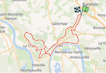
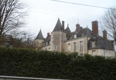
Trail Mountain bike of 40 km to be discovered at Normandy, Seine-Maritime, Villers-Écalles. This trail is proposed by tracegps.

Description

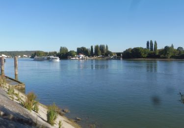
La rando parcourt les vallons de l'Austreberthe, elle commence par longer l'ancienne voie de chemin de fer Barentin Duclair sur des chemins assez rocailleux puis vous pénétrez dans la forêt juste derrière le stade de foot de Duclair (superbe point de vue en montant la côte). Cela vous lance sur une boucle d'environ 24 km à travers tous les styles de chemins (single-track, route forestière, chemin boueux, tunnel et même une petite section de bosses). A la sortie de la forêt, vous suivez la Seine (possibilité d'acheter quelques fruits selon les jours) et vous traversez Duclair afin de rejoindre le GR 2 (superbe point de vue encore). En arrivant en haut de la côte, de nouveau la forêt (St Pierre de Varengeville) jusqu’à passer devant un Christ en pleine forêt (!!!) puis retour sur les hauteurs de Villers Ecalles pour redescendre au parking par un sentier.

Elevation profile

Positioning

Country:
France
Region :
Normandy
Department/Province :
Seine-Maritime
Municipality :
Villers-Écalles
Location:
Unknown
Start:(UTM)
350279 ; 5488214 (31U) N.

Trails nearby

Trail Walking Saint-Pierre-de-Varengeville - La voie verte au Paulu - Photo
Walking
JMCMoreau

Walking

Easy
(1)
Saint-Pierre-de-Varengeville, Normandy, Seine-Maritime, France
4.9 km | 6 km-effort
1h 18min
Yes
Trail Walking Saint-Pierre-de-Varengeville - Boucle du Paulu à Duclair - Photo
Walking
JMCMoreau

Walking

Difficult
(1)
Saint-Pierre-de-Varengeville, Normandy, Seine-Maritime, France
13.1 km | 16.2 km-effort
3h 29min
Yes
Trail Walking Saint-Pierre-de-Varengeville - Autour du Paulu - Photo
Walking
JMCMoreau

Walking

Easy
(1)
Saint-Pierre-de-Varengeville, Normandy, Seine-Maritime, France
4.2 km | 5.7 km-effort
1h 13min
Yes
Trail Walking Pavilly - 076-90-Pavilly / St Autreberthe  13.5km - Photo
Walking
rvs147

Walking

Medium
(1)
Pavilly, Normandy, Seine-Maritime, France
12 km | 15 km-effort
3h 23min
Yes
Trail Walking Saint-Pierre-de-Varengeville - 20240229-St Pierre de Varengeville - Photo
Walking
doudet

Walking

Medium
Saint-Pierre-de-Varengeville, Normandy, Seine-Maritime, France
12.5 km | 15 km-effort
3h 6min
Yes
Trail Walking Saint-Paër - saint paër - Photo
Walking
nicole.reine@wanadoo.fr

Walking

Medium
Saint-Paër, Normandy, Seine-Maritime, France
7.2 km | 8.7 km-effort
2h 16min
Yes
Trail Walking Barentin - 20221006-Barentin  - Photo
Walking
doudet

Walking

Medium
Barentin, Normandy, Seine-Maritime, France
13.7 km | 16.1 km-effort
3h 40min
Yes
Trail Walking Pavilly - 20220203-Pavilly - Photo
Walking
doudet

Walking

Medium
Pavilly, Normandy, Seine-Maritime, France
12.1 km | 15 km-effort
3h 36min
Yes
Trail Walking Saint-Pierre-de-Varengeville - 20211014-Duclair parcours de l'Anerie (ne pas publier) - Photo
Walking
doudet

Walking

Medium
Saint-Pierre-de-Varengeville, Normandy, Seine-Maritime, France
13.1 km | 16.2 km-effort
3h 50min
Yes


Close
My subscriptions