Trail Mountain bike Ville-du-Pont - La Belle d'Entreroche - Ville du Pont - Photo

La Belle d'Entreroche - Ville du Pont

 tracegps
tracegps

User

© OpenStreetMap contributors
Length
Length
18.1 km
Max alt
Max alt
965 m
Uphill gradient
Uphill gradient
377 m
Km-Effort
Km-Effort  
23 km
Min alt
Min alt
781 m
Downhill gradient
Downhill gradient
377 m
Boucle
Boucle
Yes
Creation date :
2014-12-10 00:00:00.0
Updated on :
2014-12-10 00:00:00.0

(0 Reviews)

Mountain bike
Mountain bike
2h00
Difficulty : Medium

Scan this QR Code to open this trail in the SityTrail application

FREE GPS app for hiking

Logo SityTrail SityTrail

IGN / Geographical institutes

Download SityTrail from the App Store Download SityTrail from Google Play

Logo SityTrail SityTrail World

The world is yours!

Download SityTrail from the App Store Download SityTrail from Google Play Download SityTrail on Huawei AppGallery

About

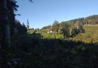
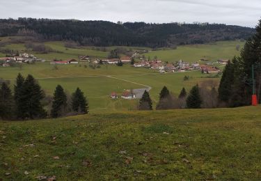
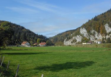
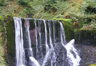
Trail Mountain bike of 18.1 km to be discovered at Bourgogne-Franche-Comté, Doubs, Ville-du-Pont. This trail is proposed by tracegps.

Description

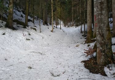
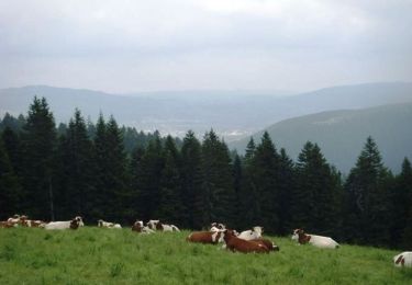
Découverte de la République du Sauget , des paysages du haut Doubs et du début du défilé d’Entre Roche. Circuit varié : Chemin en forêt, chemins blancs, et un peu de goudron sur très petites routes. Circuit glissant par endroit après pluies - 200 m de poussage selon forme physique.

Elevation profile

Positioning

Country:
France
Region :
Bourgogne-Franche-Comté
Department/Province :
Doubs
Municipality :
Ville-du-Pont
Location:
Unknown
Start:(UTM)
308348 ; 5208644 (32T) N.

Trails nearby

Trail Walking Les Gras - Les Gras
Walking
eltonnermou

Walking

Medium
Les Gras, Bourgogne-Franche-Comté, Doubs, France
13.3 km | 19 km-effort
4h 35min
Yes
Trail Walking La Chaux - la petite chaux - Photo
Walking
eltonnermou

Walking

Easy
(1)
La Chaux, Bourgogne-Franche-Comté, Doubs, France
15.1 km | 20 km-effort
2h 40min
Yes
Trail Walking Les Gras - les gras - Photo
Walking
eltonnermou

Walking

Medium
Les Gras, Bourgogne-Franche-Comté, Doubs, France
14 km | 21 km-effort
5h 3min
Yes
Trail Walking Les Combes - Remonot 8 octobre 2020 CAF - Photo
Walking
TRIMAILLE

Walking

Difficult
Les Combes, Bourgogne-Franche-Comté, Doubs, France
21 km | 32 km-effort
6h 44min
Yes
Trail Mountain bike Hauterive-la-Fresse - j4 - Photo
Mountain bike
Thierry Lalouze

Mountain bike

Very difficult
Hauterive-la-Fresse, Bourgogne-Franche-Comté, Doubs, France
64 km | 88 km-effort
5h 11min
No
Trail Walking Arc-sous-Cicon - CRET MONNIOT - Photo
Walking
legios84

Walking

Medium
Arc-sous-Cicon, Bourgogne-Franche-Comté, Doubs, France
19.4 km | 26 km-effort
3h 40min
Yes
Trail Snowshoes La Chaux - Cret Moniot raquettes CAF - Photo
Snowshoes
TRIMAILLE

Snowshoes

Difficult
La Chaux, Bourgogne-Franche-Comté, Doubs, France
14.8 km | 19.9 km-effort
5h 52min
Yes
Trail Walking Les Gras - Le mont Châteleu - Photo
Walking
tracegps

Walking

Medium
Les Gras, Bourgogne-Franche-Comté, Doubs, France
18.5 km | 29 km-effort
5h 30min
Yes
Trail Walking Les Gras - Le Mont Châteleu - Doubs - Photo
Walking
tracegps

Walking

Difficult
(1)
Les Gras, Bourgogne-Franche-Comté, Doubs, France
12.8 km | 20 km-effort
4h 0min
Yes


Close
My subscriptions