Trail Walking Perville - Circuit de Furet - Perville - Photo

Circuit de Furet - Perville

 tracegps
tracegps

User

© OpenStreetMap contributors
Length
Length
6 km
Max alt
Max alt
194 m
Uphill gradient
Uphill gradient
145 m
Km-Effort
Km-Effort  
8 km
Min alt
Min alt
76 m
Downhill gradient
Downhill gradient
145 m
Boucle
Boucle
Yes
Creation date :
2014-12-10 00:00:00.0
Updated on :
2014-12-10 00:00:00.0

(0 Reviews)

Walking
Walking
1h30
Difficulty : Easy

Scan this QR Code to open this trail in the SityTrail application

FREE GPS app for hiking

Logo SityTrail SityTrail

IGN / Geographical institutes

Download SityTrail from the App Store Download SityTrail from Google Play

Logo SityTrail SityTrail World

The world is yours!

Download SityTrail from the App Store Download SityTrail from Google Play Download SityTrail on Huawei AppGallery

About

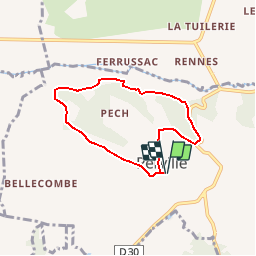
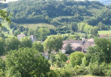
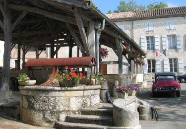
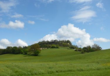
Trail Walking of 6 km to be discovered at Occitania, Tarn-et-Garonne, Perville. This trail is proposed by tracegps.

Description

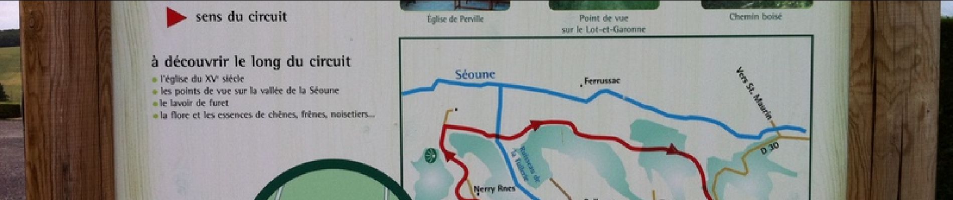
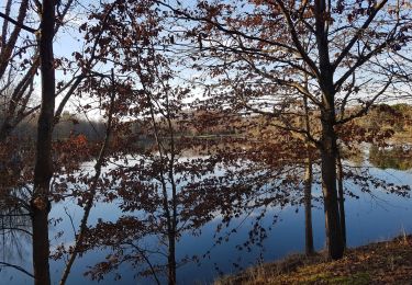
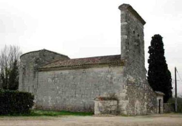
A découvrir le long du circuit: - l'église du XVème siècle - les points de vue sur la vallée de la Séoune - le lavoir de Furet - la flore et les essences de chênes, frênes, noisetiers.

Elevation profile

Photos

Positioning

Country:
France
Region :
Occitania
Department/Province :
Tarn-et-Garonne
Municipality :
Perville
Location:
Unknown
Start:(UTM)
330658 ; 4894057 (31T) N.

Trails nearby

Trail Walking Tayrac - Tayrac, le circuit du menhir - Pays de l'Agenais - Photo
Walking
tracegps

Walking

Difficult
(1)
Tayrac, New Aquitaine, Lot-et-Garonne, France
14.1 km | 18.5 km-effort
3h 45min
Yes
Trail Walking Lamagistère - Coupet retenue canal lac bleu - Photo
Walking
jlc12

Walking

Easy
Lamagistère, Occitania, Tarn-et-Garonne, France
11.1 km | 12 km-effort
1h 25min
Yes
Trail Equestrian Tayrac - Tayrac, le circuit du menhir - Pays de l'Agenais - Photo
Equestrian
tracegps

Equestrian

Difficult
Tayrac, New Aquitaine, Lot-et-Garonne, France
14.1 km | 18.5 km-effort
2h 19min
Yes
Trail Mountain bike Tayrac - Tayrac, le circuit du menhir - Pays de l'Agenais - Photo
Mountain bike
tracegps

Mountain bike

Difficult
Tayrac, New Aquitaine, Lot-et-Garonne, France
14.1 km | 18.5 km-effort
1h 45min
Yes
Trail Equestrian Saint-Maurin - Saint-Maurin / Ferrussac, randonnée dans les vergers - Pays de l'Agenais - Photo
Equestrian
tracegps

Equestrian

Medium
Saint-Maurin, New Aquitaine, Lot-et-Garonne, France
12.5 km | 16.3 km-effort
2h 10min
Yes
Trail Mountain bike Saint-Maurin - Saint-Maurin / Ferrussac, randonnée dans les vergers - Pays de l'Agenais - Photo
Mountain bike
tracegps

Mountain bike

Medium
Saint-Maurin, New Aquitaine, Lot-et-Garonne, France
12.5 km | 16.3 km-effort
1h 30min
Yes
Trail Walking Saint-Maurin - Saint-Maurin / Ferrussac, randonnée dans les vergers - Pays de l'Agenais - Photo
Walking
tracegps

Walking

Medium
Saint-Maurin, New Aquitaine, Lot-et-Garonne, France
12.5 km | 16.3 km-effort
3h 15min
Yes
Trail Walking Saint-Maurin - Saint-Maurin / Saint-Pierre-del-Pech, la balade de l'abbaye - Pays de l'Agenais - Photo
Walking
tracegps

Walking

Easy
Saint-Maurin, New Aquitaine, Lot-et-Garonne, France
4.5 km | 6 km-effort
1h 15min
Yes
Trail Mountain bike Clermont-Soubiran - Clermont-Soubiran, des coteaux du Pays de Serres au Canal de Garonne - Pays de l'Agenais - Photo
Mountain bike
tracegps

Mountain bike

Difficult
Clermont-Soubiran, New Aquitaine, Lot-et-Garonne, France
21 km | 27 km-effort
2h 49min
Yes


Close
My subscriptions